
Country Honduras Municipality since 1835 Area 221 km² | Department Lempira Climate Aw Population 9,093 (2015) | |
 | ||
Cancha de f tbol de cololaca lempira no ser destru da
Cololaca is a municipality in the Honduran department of Lempira.
Contents
- Cancha de f tbol de cololaca lempira no ser destru da
- Unos 300 pobladores de cololaca lempira protestan porque su nica cancha de f tbol ser destru da
- History
- Geography
- Boundaries
- Population
- Tourism
- References
Cololaca is one of the municipalities of the Lempira department. It is located more than 200 km away from Gracias. There is also an alternate way to go there, and that is taking a deviation in San Marcos de Ocotepeque. Taking this unpaved road takes about 30 minutes to Cololaca. The Government is currently working on paving the road from San Marcos de Ocotepeque to Cololaca.
Unos 300 pobladores de cololaca lempira protestan porque su nica cancha de f tbol ser destru da
History
It started in a private property, that belonged to an old community, back in 1628. According to tales of elderly inhabitants, it became legal as a municipality in 1835, from Guarita district.
Geography
The forests around Cololaca are Dry Sub Tropical forest, because they reflect the lack of water, but during the rainy season everything becomes green. It has very high and steep hills. And also many places ideal for cattle.
Boundaries
Its boundaries are:
Population
The typical cross-breed of native Indians and Spanish settlers is seen in Cololaca.
Tourism
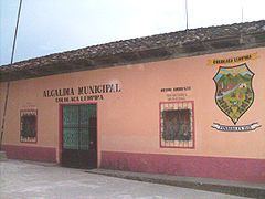
Cololaca has the typical distribution of colonial architecture. There is electricity and coverage for mobile phones. There are no recommendable hostels in Cololaca, but fortunately San Marcos de Ocotepeque is near with very good accommodations and venues for entertainment.