
Country United States County Hampden Incorporated 1810 Elevation 463 m Population 426 (2000) Area code 413 | Settled 1750 Time zone Eastern (UTC-5) Founded 1810 Local time Sunday 5:52 AM | |
 | ||
Weather -1°C, Wind NW at 13 km/h, 95% Humidity Area 84.95 km² (81.84 km² Land / 2.849 km² Water) | ||
Tolland is a town in Hampden County, Massachusetts, United States. It is part of the Springfield, Massachusetts Metropolitan Statistical Area. The population was 485 at the 2010 census, making it the smallest town in Hampden County by population.
Contents
Map of Tolland, MA, USA
History
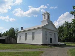
Tolland was first settled in 1750 when it was part of neighboring Granville. Tolland was officially incorporated in 1810. Tolland formerly had a popular "Black Fly Day" parade to celebrate the old black fly tribe that once ruled the land as feared cannibals. The parade was celebrated in June, but it now has been replaced with a picnic on the town green.
Geography
According to the US Census Bureau, the town has a total area of 32.8 square miles (85 km2), of which 31.6 square miles (82 km2) is land and 1.1 square miles (2.8 km2) (3.48%) is water.
Tolland is bordered on the north by Otis and Blandford, on the east by Granville, on the south by Hartland and Colebrook, Connecticut, and on the west by Sandisfield.
Tolland State Forest and Granville State Forest protect a part of the town's area.
Demographics
As of the census of 2000, there were 426 people, 169 households, and 114 families residing in the town. The population density was 13.5 people per square mile (5.2/km²). There were 478 housing units at an average density of 15.1 per square mile (5.8/km²). The racial makeup of the town was 97.42% White, 0.94% African American, 1.17% Native American, 0.23% Asian, and 0.23% from two or more races. Hispanic or Latino of any race were 1.17% of the population.
There were 169 households out of which 26.6% had children under the age of 18 living with them, 66.3% were married couples living together, 1.2% had a female householder with no husband present, and 32.0% were non-families. 28.4% of all households were made up of individuals and 13.0% had someone living alone who was 65 years of age or older. The average household size was 2.52 and the average family size was 3.06.
In the town, the population was spread out with 23.9% under the age of 18, 3.3% from 18 to 24, 31.0% from 25 to 44, 28.9% from 45 to 64, and 12.9% who were 65 years of age or older. The median age was 41 years. For every 100 females there were 114.1 males. For every 100 females age 18 and over, there were 118.9 males.
The median income for a household in the town was $53,125, and the median income for a family was $65,417. Males had a median income of $41,094 versus $35,278 for females. The per capita income for the town was $30,126. About 2.3% of families and 4.2% of the population were below the poverty line, including none of those under age 18 and 17.7% of those age 65 or over.
Library
The Tolland Public Library was established in 1892. In fiscal year 2008, the town of Tolland spent 0.97% ($10,271) of its budget on its public library—some $22 per person.