
OS grid reference SU290583 Local time Friday 7:49 PM Civil parish Tidcombe and Fosbury UK parliament constituency Devizes | Sovereign state United Kingdom Postcode district SN8 Dialling code 01264 | |
 | ||
Weather 11°C, Wind S at 18 km/h, 71% Humidity | ||
Tidcombe primary school year five six tudor day
Tidcombe is a small village in Wiltshire, England, on the eastern edge of the county, near Hampshire. It is about 9 miles (14 km) southeast of Marlborough and 7 miles (11 km) southwest of Hungerford, Berkshire. With few inhabitants, it forms part of the civil parish of Tidcombe and Fosbury, which has a parish meeting.
Contents
- Tidcombe primary school year five six tudor day
- Map of Tidcombe Marlborough UK
- Alastair tidcombe golf swing 2012
- References
Map of Tidcombe, Marlborough, UK
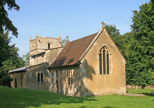
There is evidence of a church in the mid 13th century. The Anglican Church of St Michael has a 17th-century tower and is Grade II* listed. Tidcombe manor house, from the mid to late 18th century, is also Grade II* listed.
On both sides of the parish boundary with Fosbury lies the Iron Age hill fort of Fosbury Camp.
Alastair tidcombe golf swing 2012
References
Tidcombe Wikipedia(Text) CC BY-SA