
Population 183 (2011) Sovereign state United Kingdom | OS grid reference SK156503 Post town ASHBOURNE Local time Friday 4:11 AM | |
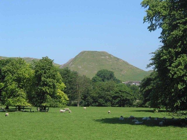 | ||
Weather 11°C, Wind S at 13 km/h, 81% Humidity Points of interest Thorpe Cloud, Dovedale stepping stones, Dovedale National Nature R | ||
Thorpe is a village and civil parish in the English county of Derbyshire; it is on the Derbyshire/Staffordshire border, on the east bank of the River Dove, about four miles north of Ashbourne. The population of the civil parish as at the 2011 census was 183.
Map of Thorpe, UK
Thorpe is at the southern end of the Peak District National Park almost at the foot of Thorpe Cloud, and is an excellent base for exploring Dovedale and the Manifold Valley.
The Dovedale Dash, a 4¾ mile cross-country running race held annually each November, was first organised here in 1953.
It formerly had a railway station, Thorpe Cloud railway station, served by the LNWR Ashbourne to Buxton branch line, which linked with the Cromford and High Peak Railway at Parsley Hay. This former trackbed now forms the long distance Tissington Trail cycle and footpath trail. There is a small car park at the station site, and many walkers/cyclists leave the trail at this point to visit Dovedale or the nearby picturesque village of Ilam.