
Population 295 (2011) Sovereign state United Kingdom Local time Friday 3:32 AM | OS grid reference TA087179 | |
 | ||
Weather 14°C, Wind S at 16 km/h, 73% Humidity | ||
1080p barton road thornton curtis abcl level crossing 22 11 16
Thornton Curtis is a village and civil parish in the North Lincolnshire district of Lincolnshire, England, approximately 5 miles (8 km) south-east from the town of Barton-upon-Humber. The population (including Burnham) at the 2011 census was 295.
Contents
- 1080p barton road thornton curtis abcl level crossing 22 11 16
- Map of Thornton Curtis Ulceby UK
- Notable buildings
- Historical and latest populationdemographic details
- References
Map of Thornton Curtis, Ulceby, UK
The name Thornton is from the Old English thorn+tun, meaning "village where thorn trees grow." In the 1086 Domesday Book the name is written as "Torentune". The origin of the Curtis part of the village name is unknown.
The village is served by Thornton Abbey railway station.
Notable buildings
Nearby is the 12th-century Thornton Abbey and the Grade I listed Abbots Lodge, a country house built on the monastic ruins for the MP Sir Vincent Skinner.
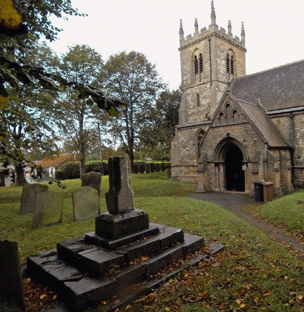
The parish church is a Grade I listed building dedicated to Saint Lawrence and dating from the 12th century. It consists of a 13th-century chancel, a nave, aisles, south porch and an embattled 13th-century western tower with eight pinnacles and containing 5 bells. The church was restored 1884 by James Fowler of Louth which included rebuilding the south porch, and new nave and chancel roofs. There is a 12th-century square black Tournai marble font, with opposed pairs of carved animals to sides, standing on a cylindrical column with shafts to each corner on a square base.
Thornton Hall is a Grade II* listed country house built between 1695 and 1700 by Sir Rowland Wynne.
There is one public house in the village, the Thornton Hunt, which dates from the 18th century and is Grade II listed.
Historical and latest population/demographic details
The population of Thornton Curtis remained relatively stable for the 110 years from 1850 to 1960; since 1960 a marked decline can be seen.
Information from the United Kingdom Census 2001: