
Population 1,711 (2011) Post town ULCEBY | OS grid reference TA109148 Sovereign state United Kingdom | |
 | ||
Region | ||
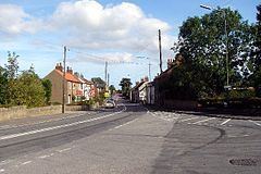
Ulceby is a village, civil parish and post town in North Lincolnshire, England. It is situated 0.5 miles (0.8 km) north from the A180 road, 10 miles (16 km) north-west from Grimsby and 14 miles (23 km) east from Scunthorpe. Ulceby is a rural village surrounded by fields, farms and the nearby villages of Habrough, Wootton and Croxton.
Contents
Map of Ulceby, UK
At the 2001 census the village had a population of 1,500 in 631 households, and at the 2011 census the village had grown to 1,711.
Facilities
Village facilities include a Co-op shop, post Office, village hall and community centre, a playing field, play area, veterinary centre, hairdressers and a guest house. There are fast food outlets: a fish and chip shop and a Chinese takeaway. Ulceby public houses are The Fox Inn, and the Yarborough Arms located 1 mile (1.6 km) from the centre of the village; a previous public house, The Brocklesby Ox, is the planned location of a new Co-operative Food shop. The village has a preschool and primary St Nicholas C of E Primary School.
Ulceby railway station, at Ulceby Skitter, is situated 1 mile, and Ulceby Truck Stop (an HGV park with cafe and petrol station) 2 miles (3 km) from the centre of village.
Religious sites and landmarks are the Anglican church of St Nicholas, Ulceby Seventh-day Adventist Chapel, and a war memorial; Ulceby Methodist Chapel closed in June 2011.