
Country United States County Knox County Population 2,781 (2010) | State Maine Time zone Eastern (EST) (UTC-5) Local time Thursday 7:48 PM | |
 | ||
Weather 4°C, Wind N at 11 km/h, 43% Humidity Area 29.73 km² (28.33 km² Land / 140 ha Water) | ||
Quarry blast at dragon cement in thomaston maine
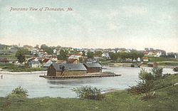
Thomaston (formerly known as Fort St. Georges, Fort Wharf, Lincoln) is a town in Knox County, Maine, United States. The population was 2,781 at the 2010 census. Noted for its antique architecture, Thomaston is an old seaport popular with tourists.
Contents
- Quarry blast at dragon cement in thomaston maine
- Map of Thomaston ME USA
- History
- Geography
- 2010 census
- 2000 census
- Fire Department
- Sites of interest
- Notable people
- References
Map of Thomaston, ME, USA
History
As early as 1630, a trading post was established on the eastern bank of the St. George River, then considered the boundary between New England and New France. In 1704, Thomas LeFebvre from Quebec bought a large tract of land along the Weskeag River on which he built a gristmill, with a house on the shoreline at what is now South Thomaston. The area became known as Thomas' Town. In 1719–1720, the old trading post was remodeled into Fort St. George, a stockaded fort protected by two blockhouses. But Abenaki Indian tribes protested the encroachment of an English fort on their territory. Instigated by the French, they attacked the garrison twice during Dummer's War in 1722, then again in 1723 with a siege lasting 30 days. In response to this and other provocations, soldiers destroyed the Abenaki stronghold of Norridgewock in 1724.
During the French and Indian War, in retaliation for the fall of Louisbourg, on August 13, 1758 French officer Boishebert left Miramichi, New Brunswick with 400 soldiers for Fort St George (Thomaston, Maine). His detachment reached there on September 9 but was caught in an ambush and had to withdraw. This was Boishébert's last Acadian expedition. They then went on to raid Friendship, Maine, where people were killed and others taken prisoner. Hostilities of the French and Indian Wars ceased with the 1759 Fall of Quebec.
Mason Wheaton was the first permanent settler in 1763. Located at the heart of the Waldo Patent, Thomaston was incorporated from St. Georges Plantation on March 20, 1777. Many settlers arrived following the Revolutionary War in 1783. General Henry Knox built his mansion, Montpelier, at Thomaston in 1793–1794.
The town prospered in the early 19th century as a port and ship building center. Around 1840, two of seven recorded millionaires in the United States were Thomaston sea captains. Other industries included two gristmills, two sawmills and planing mills, three sail lofts, brickyards, cask manufacturing and a marble works. Lime had been manufactured here since 1734 in kilns. Thomaston is still home to Jeff's Marine, Inc. and Lyman Morse Boatbuilding, builders of custom power and sailing yachts. Located on the St. George River, Lyman Morse Boatbuilding sits on a site where wooden schooners have been built for over 200 years.
Rockland and South Thomaston were set off and incorporated in 1848. The Knox and Lincoln Railroad passed through the town, carrying freight and tourists.
Thomaston was home to the state prison until 2002, when it moved to Warren and the former facility was demolished. The prison was locally famous for its shop featuring handmade wares of the prisoners. The gift shop still exists today. The prison site had been sold to the state in 1824 by former governor William King. Today, Thomaston is a resort area with a large historic district containing Federal, Greek Revival and Italianate architecture. The town was a filming location for the 1996 movie, Thinner.
In June 1875, Louis Wagner ("the Smuttynose Axe Murderer"), alongside John True Gordon ("the Thorndike Slayer"), were hanged on the gallows of the Maine State Prison of Thomaston. Louis Wagner was forgotten by history until the recent book Return to Smuttynose Island and other Maine Axe Murders by Emeric Spooner. Mr. Spooner located Wagner's grave which can still be viewed in the Old Prison Cemetery on the grounds of the former prison.
The Thomaston Historic District is listed on the National Register of Historic Places.
Geography
According to the United States Census Bureau, the town has a total area of 11.48 square miles (29.73 km2), of which, 10.94 square miles (28.33 km2) of it is land and 0.54 square miles (1.40 km2) is water. Thomaston is drained by the St. George River, Weskeag River, Mill River and Oyster River.
The town is crossed by U. S. Route 1 and Maine State Route 131. It is bordered by the towns of Rockland to the northeast, South Thomaston to the south, Cushing to the southwest, and Warren to the northwest.
2010 census
As of the census of 2010, there were 2,781 people, 1,219 households, and 767 families residing in the town. The population density was 254.2 inhabitants per square mile (98.1/km2). There were 1,385 housing units at an average density of 126.6 per square mile (48.9/km2). The racial makeup of the town was 97.0% White, 0.3% African American, 0.5% Native American, 0.8% Asian, 0.1% from other races, and 1.4% from two or more races. Hispanic or Latino of any race were 0.5% of the population.
There were 1,219 households of which 28.6% had children under the age of 18 living with them, 45.6% were married couples living together, 13.4% had a female householder with no husband present, 3.9% had a male householder with no wife present, and 37.1% were non-families. 30.4% of all households were made up of individuals and 14% had someone living alone who was 65 years of age or older. The average household size was 2.25 and the average family size was 2.73.
The median age in the town was 44 years. 21.1% of residents were under the age of 18; 6.7% were between the ages of 18 and 24; 23.4% were from 25 to 44; 30.8% were from 45 to 64; and 18.1% were 65 years of age or older. The gender makeup of the town was 46.9% male and 53.1% female.
2000 census
As of the census of 2000, there were 3,748 people, 1,436 households, and 887 families residing in the town. The population density was 343.2 people per square mile (132.5/km²). There were 1,535 housing units at an average density of 140.5 per square mile (54.3/km²). The racial makeup of the town was 97.81% White, 0.61% Black or African American, 0.21% Native American, 0.48% Asian, 0.03% Pacific Islander, 0.05% from other races, and 0.80% from two or more races. Hispanic or Latino of any race were 0.43% of the population.
There were 1,436 households out of which 27.9% had children under the age of 18 living with them, 47.4% were married couples living together, 10.3% had a female householder with no husband present, and 38.2% were non-families. 31.7% of all households were made up of individuals and 15.6% had someone living alone who was 65 years of age or older. The average household size was 2.31 and the average family size was 2.88.
In the town, the population was spread out with 20.5% under the age of 18, 8.1% from 18 to 24, 30.7% from 25 to 44, 25.8% from 45 to 64, and 15.0% who were 65 years of age or older. The median age was 39 years. For every 100 females there were 114.9 males. For every 100 females age 18 and over, there were 116.6 males.
The median income for a household in the town was $33,306, and the median income for a family was $42,319. Males had a median income of $29,894 versus $21,295 for females. The per capita income for the town was $17,199. About 8.1% of families and 12.8% of the population were below the poverty line, including 12.1% of those under age 18 and 15.9% of those age 65 or over.
Fire Department
The Fire Department currently runs three pumpers, one ladder truck with a 75' aerial ladder, one utility/brush truck and one ambulance. The Fire Department is an all volunteer service.