
Area codes 231, 2391-2397 Area 3,683 km² | Postal codes 54x xx - 57x xx ISO 3166 code GR-54 Population 1.11 million (2011) | |
 | ||
Colleges and Universities Aristotle University of Thessa, University of Macedonia, International Hellenic University, CITY College - Internatio, Mediterranean College Thessaloniki Points of interest Archaeological Museum of Thessaloniki, White Tower of Thessaloniki, Arch of Galerius and Rotu, Hagia Sophia - Thessaloniki, Museum of Byzantine Culture | ||
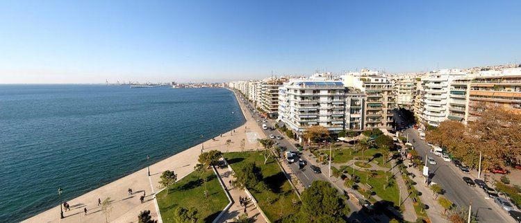
Thessaloniki (Greek: Περιφερειακή ενότητα Θεσσαλονίκης) is one of the regional units of Greece. It is part of the Region of Central Macedonia and its capital is the city of Thessaloniki.
Contents
- Map of Thessaloniki Greece
- Geography
- History
- Municipalities
- Prefecture
- Provinces
- Roads and highways
- Mass transit
- Communications
- Major Sport Clubs
- References
Map of Thessaloniki, Greece
Geography
The regional unit stretches from the Thermaic Gulf to the Strymonic Gulf. The Thermaic Gulf lies to the southwest while the Strymonic Gulf is in the east. Two bodies of water are located to the north, Lake Koronia in the heart of the regional unit and Lake Volvi to the east. There are farmlands throughout the western and the southwestern part, a few in the northeast, the north and along the Axios River valley. The mountains include the Chortiatis to the westcentral part, the Vertiskos to the north and parts of the Kerdylio mountains to the northeast. The regional unit borders on the Imathia regional unit to the southwest, Pella to the west, Kilkis to the north, Serres to the east and Chalkidiki to the south.
Its climate includes hot Mediterranean summers and cool to mild winters in low-lying areas and its plains. Winter weather is very common in areas 500 m above sea level and into the mountains.
History
The area of the Thessaloniki regional unit joined the rest of Greece in 1912, during the First Balkan War. The area was struck by an earthquake in 1978, and by flooding due to rainfall in October 2006. Thessaloniki is also the birthplace of Mustafa Kemal, founder of the modern Turkey.
Municipalities
The Thessaloniki regional unit is subdivided into 14 municipalities. These are (number as in the map in the infobox):
Prefecture
The Thessaloniki Prefecture (Greek: Νομός Θεσσαλονίκης) was created when the area joined with the rest of Greece during the First Balkan War in 1913. Its area was then the largest in the country covering about 7% of all of Greece. The prefectures of Pella and Kilkis were split off in 1930 and 1937 respectively, and after World War II in 1947, Imathia and Pieria.
As a part of the 2011 Kallikratis government reform, the prefecture was transformed into a regional unit within the Central Macedonia region, without any change in boundaries. At the same time, the municipalities were reorganised, according to the table below.
Provinces
Note: Provinces no longer hold any legal status in Greece.
Roads and highways
The regional unit of Thessaloniki is connected with the following roads and highways.
History
The GR-1 and GR-2 used to be the main road links connecting the regional unit of Thessaloniki with other parts of the country, up until the A1/E75 motorway (constructed during the 1970s) and the A2/E90 motorway (constructed during the 90's) were delivered to the public. Furthermore, parts of the GR-67 (in the near future to form part of the A25) linking Chalkidiki and the GR-65 linking Kilkis, were converted into motorways during the 2000s.
Mass transit
Communications
Most of the stations are in the city (see Thessaloniki#Communications). Here are list of stations outside the city: