
 | ||
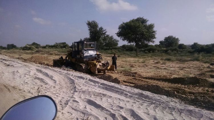
Sindh cm syed murad ali shah visit model village near thar coalfield block 2 7 dec 2016
The Thar coalfield is located in Thar Desert, Tharparkar District of Sindh province in Pakistan. The deposits - 16th largest coal reserves in the world, were discovered in 1991 by Geological Survey of Pakistan (GSP) and the United States Agency for International Development.
Contents
- Sindh cm syed murad ali shah visit model village near thar coalfield block 2 7 dec 2016
- Location
- Relief topography and climate
- Water
- Geology
- Coal
- Reserves
- References
Pakistan has emerged as one of the leading countries - seventh in the list of top 20 countries of the world after the discovery of huge lignite coal resources in Sindh. The economic coal deposits of Pakistan are restricted to Paleocene and Eocene rock sequences. It is one of the world’s largest lignite deposits discovered by GSP in 90’s, spread over more than 9,000 km2. comprise around 175 billion tonnes sufficient to meet the country’s fuel requirements for centuries.
Sindh Engro Coal Mining Company mine's coal from the field.
Location
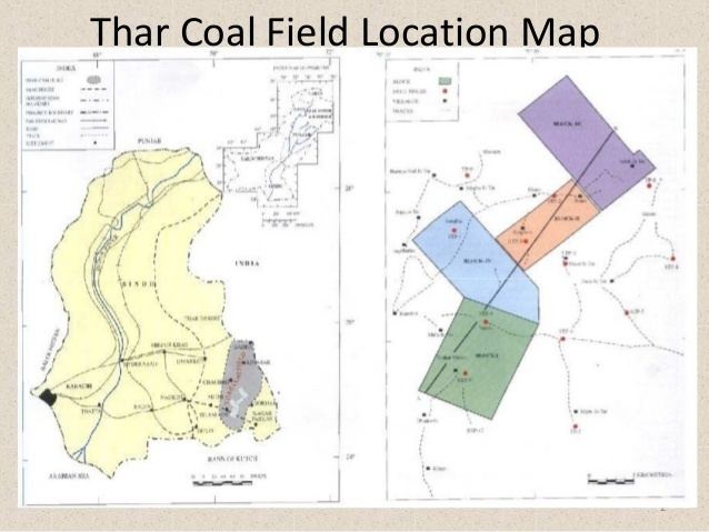
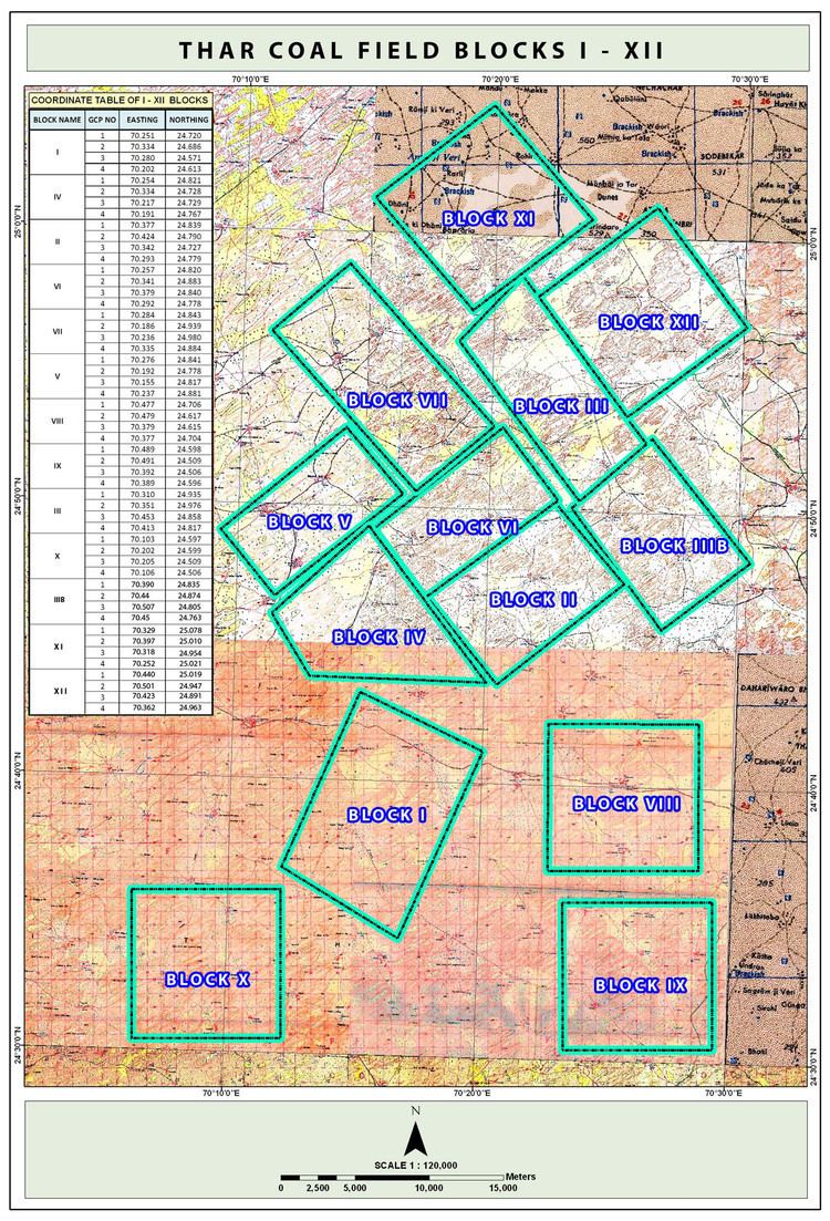
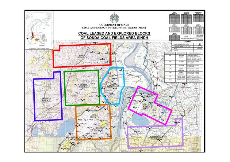
The Thar coalfield is located approximately between Latitudes 24°15’N and 25°45’N and Longitudes 69° 45’E and 70° 45’E in the southern part of Sindh Province in the Survey of Pakistan topo-sheet Nos. 40 L/2,5 and 6. Based on available infrastructure and favourable geology, the Geological Survey of Pakistan selected four blocks near Islamkot for exploration and assessment of coal resources. The blocks with names, area and coordinates are given in Table-1:¬
The area is accessible by a 410 kilometers metalled road from Karachi to Islamkot via Hyderabad-Mirpur Khas-Naukot and Thatta-Badin-Mithi-Islamkot. A road network connecting all the major towns with Thar Coalfield have been developed. The rail link from Hyderabad is up to Naukot, which is about 100 kilometers from Islamkot.
Relief, topography and climate
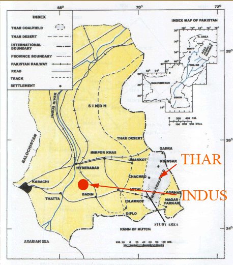
Thar coalfield is a part of the Thar Desert of Pakistan, the 9th largest desert of the world. It is bounded in the north, east and south by India, in the west by flood plains of the Indus River. The terrain is sandy and rough with sand dunes forming the topography. The relief in the area varies between near sea level to more than 150 meters AMSL.
The climate is essentially that of an arid to semi-arid region with scorching hot summers and relatively cold winters. It is one of the most densely populated deserts of the world with over 91 thousand inhabitants. The livelihood of the population depends on agriculture and livestock.
Water
The area is a part of the desert where precipitation is very little with a high rate of evaporation. As such, limited water resources are of great significance.
A. SURFACE WATER -The water is scanty and found in a few small “tarais” and artificially dug depressions where rain water collects. These depressions generally consist of silty clay and caliche material.
B. GROUNDWATER -The hydro geological studies and drill hole geology shows the presence of three possible aquifer zones at varying depths: (i) above the coal zone (ii) within the coal zone and (iii) below the coal zone.
Drilling data has indicated three aquifers (water-bearing Zones) at an average depth of 50 m, 120 m and more than 200 meters:
Geology
The Thar coalfield area is covered by dune sand that extends to an average depth of over 80 meters and rests upon a structural platform in the eastern part of the desert. The generalized stratigraphic sequence in the Thar coalfield area is shown in table. It comprises Basement Complex, coal bearing Bara Formation, alluvial deposits and dune sand.
Coal
The coal beds of variable thickness ranging from 0.20 – 22.81 meters are developed. The maximum number of coal seams found in some of the drill holes is 20. The cumulative thickness of the coal beds range from 0.2 to 36 meters. Claystone invariably forms the roof and the floor rock of the coal beds. The coal is brownish black, black and grayish black in colour. It is poorly to well cleared and compact. The quality of coal is better where percentage of clay is nominal.
Reserves
As a result of widespread drilling over an area of 9000 km2, a total of 175 billion tons of coal resource potential has been assessed, equivalent to total oil reserves of Saudi Arabia and Iran combined and can be used to produce 100,000 MW for 300 years. Detailed evaluation on four blocks has following results.
The overburden consists of three kinds of material; dune sand, alluvium and sedimentary sequence. The total overburden is around 150 to 230 meters. The roof and the floor rocks are claystone and loose sandstone beds.