
Existed: 1991 – present Counties: Jeff Davis Constructed 1991 | North end: Spur 78 Length 769 m | |
 | ||
South end: Mt. Fowlkes summit, McDonald Observatory | ||
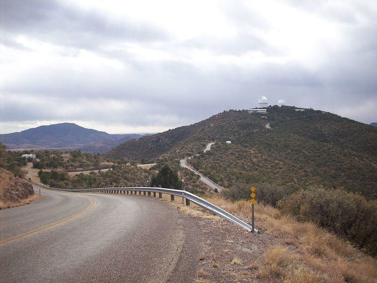
Texas State Highway Spur 77 or Spur 77 is a spur road maintained by the Texas Department of Transportation (TxDOT) connecting the University of Texas at Austin's McDonald Observatory complex atop Mt. Fowlkes to Spur 78 16.3 miles (26.2 km) from Fort Davis. The road is 0.5 miles (0.8 km) long and is located within Jeff Davis County.
Contents
Previously, the route designation belonged to a loop road in the Texas Panhandle.
Swisher County
The numerical designation originally belonged to Texas State Highway Loop 77 in the town of Tulia in Swisher County. This original route was in place by the time the state's Highway Designation Files were established in 1939. The Tulia loop began at the intersection of U.S. Route 87 and State Highway 86 and continued east along SH 86 to the present day Farm to Market Road 146. The loop then followed north over the route of FM 146 to the intersection with present-day FM 1318. The loop then continued west back to US 87.
In 1951, the loop designation was dropped along the portions following SH 46 and FM 146, and the designation of the remaining portion was eliminated in 1963 with that stretch reassigned to FM 1318.
Jeff Davis County
The current spur was established in 1991 to provide state highway access to McDonald's growing cluster of observational facilities at the summit of Mt. Fowlkes.
Route description
The spur begins at McDonald Observatory's complex of facilities at the summit of Mt. Fowlkes including NASA's Laser Ranging System and the Hobby-Eberly Telescope. The spur then follows 0.5 miles (0.8 km) along the saddle of a ridge joining Mt. Fowlkes to Mt. Locke until it terminates at Spur 78 1.0 mile (1.6 km) from SH 118 and 0.5 miles (0.8 km) from the observatory's facilities atop Mt. Locke.
Major intersections
The entire route is in McDonald Observatory, Jeff Davis County.