
Country United States FIPS code 48-26688 Elevation 1,491 m Zip code 79734 Area code Area code 432 | Time zone Central (CST) (UTC-6) GNIS feature ID 1357584 Area 14.5 km² Population 1,201 (2010) | |
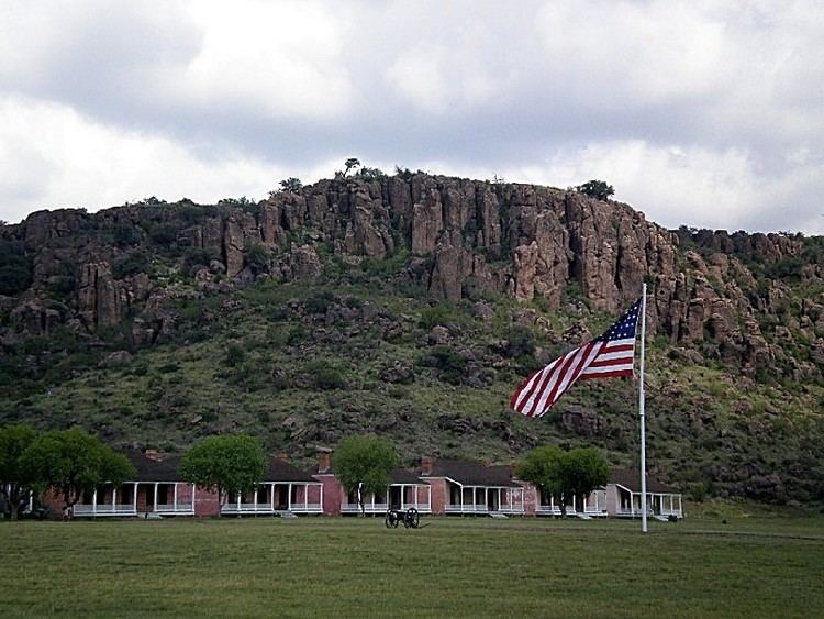 | ||
Fort Davis is a census-designated place (CDP) in Jeff Davis County, Texas, United States. The population was 1,050 at the 2000 census and 1,041 according to a 2007 estimate. It is the county seat of Jeff Davis County. It was the site of Fort Davis established in 1854 on the San Antonio-El Paso Road through west Texas and named after Jefferson Davis, who was then the Secretary of War under President Franklin Pierce.
Contents
Map of Fort Davis, TX 79734, USA
Geography
Fort Davis is located at 30°35′34″N 103°53′31″W (30.592880, -103.891996).
According to the United States Census Bureau, the CDP has a total area of 5.6 square miles (15 km2), all land.
Fort Davis has the highest elevation above sea level of any county seat in Texas; the elevation is 5,050 feet.
Demographics
As of the census of 2000, there were 1,050 people, 415 households, and 298 families residing in the CDP. The population density was 188.2 people per square mile (72.7/km²). There were 525 housing units at an average density of 94.1 per square mile (36.3/km²). The racial makeup of the CDP was 88.29% White, 0.19% African American, 0.48% Native American, 7.62% from other races, and 3.43% from two or more races. Hispanic or Latino of any race were 49.33% of the population.
There were 415 households out of which 32.0% had children under the age of 18 living with them, 57.6% were married couples living together, 10.6% had a female householder with no husband present, and 28.0% were non-families. 24.3% of all households were made up of individuals and 9.9% had someone living alone who was 65 years of age or older. The average household size was 2.53 and the average family size was 3.02.
In the CDP, the population was spread out with 24.7% under the age of 18, 7.4% from 18 to 24, 26.9% from 25 to 44, 25.4% from 45 to 64, and 15.6% who were 65 years of age or older. The median age was 39 years. For every 100 females there were 102.3 males. For every 100 females age 18 and over, there were 97.3 males.
The median income for a household in the CDP was $25,882, and the median income for a family was $27,955. Males had a median income of $22,500 versus $20,000 for females. The per capita income for the CDP was $14,249. About 20.7% of families and 21.6% of the population were below the poverty line, including 26.3% of those under age 18 and 26.0% of those age 65 or over.
Climate
Fort Davis experiences a semi-arid climate (Köppen BSk) with cool, dry winters and hot, dry summers.
Points of interest
Education
Fort Davis is served by the Fort Davis Independent School District.