
Elevation 250 m Max length 5.4 km Postal code 744301 | Total islands 1 Width 19.6 km (12.18 mi) Area 86.5 km² Literacy 84.4% Area code 03192 | |
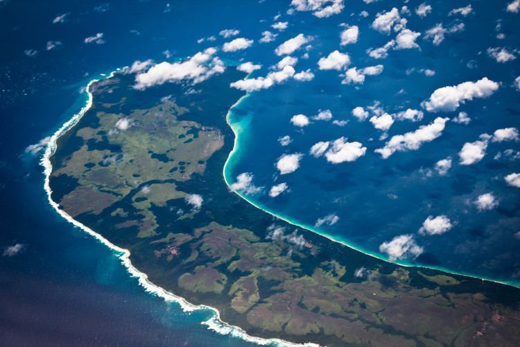 | ||
Teressa (Luroo in the Teressa language, Hindi: तेरेस्सा, also called Tarasa Dwip) is one of the Nicobar Islands, India.
Contents
Map of Teressa, Andaman and Nicobar Islands 744303
History
When Austria (1778-1784) and Denmark (1754/56-1868) claimed Nicobar Islands as a colony, They named Teressa after the Austrian Arch-duchess Maria Theresia. Extensive damage to the island's flora and fauna occurred following the 2004 Indian Ocean earthquake and tsunami.
Geography
Teressa lies west of the neighboring island of Camorta and northwest of Katchal. The smaller island known as Chowra is to the north and Bompoka lies to the east. The northern portion of the island has elevations reaching 87 meters. The island has a surface area of 101.26 km².
Demography
The Indian National Census of 2011 showed the island to have a population of 1,934, and the largest settlements were: Bengali (354), Kalasi (335), and Minyuk (305).
Administration
The island belongs to the township of Nancowry of Teressa Taluk.