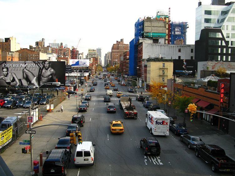
Maintained by NYCDOT South end West Street Major cities New York City | Length 10.5 mi (16.9 km) North end Fort George Avenue Commissioned March 1811 | |
 | ||
East Ninth Avenue (below 59th St) | ||
Tenth Avenue, known as Amsterdam Avenue between 59th Street and 193rd Street, is a north-south thoroughfare on the West Side of Manhattan in New York City. It carries uptown (northbound) traffic as far as West 110th Street – also known as Cathedral Parkway, after which it continues as a two-way street.
Contents
Map of Amsterdam Ave, New York, NY, USA
Geography
Tenth Avenue begins a block below Gansevoort Street and Eleventh Avenue in the West Village / Meatpacking District. For the southernmost stretch (the four blocks below 14th Street), Tenth Avenue runs southbound. North of 14th Street, Tenth Avenue runs uptown (northbound) for 45 blocks as a one-way street until its intersection with West 59th Street, where it becomes Amsterdam Avenue but continues without interruption. Amsterdam Avenue continues as a one-way street northbound until Cathedral Parkway, where two-way traffic resumes.
As Amsterdam Avenue, the thoroughfare stretches 129 blocks north – narrowing to one lane in each direction as it passes through Yeshiva University's Wilf Campus, between 184th and 186th Streets – before connecting with Fort George Avenue south of Highbridge Park at West 193rd Street.
On the north side of Highbridge Park, unconnected to Amsterdam Avenue on the south side, Tenth Avenue then runs for slightly less than a mile from the northern terminus of the Harlem River Drive at Dyckman Street, to the intersection of West 218th Street and Broadway, where it merges into Broadway.
History
Tenth Avenue runs through the Chelsea and Hell's Kitchen neighborhoods on the west side of the borough, and then as Amsterdam Avenue, through the Upper West Side, Harlem and Washington Heights. Much of these areas were working class or poor for much of the 20th century. The street has long been noted for its commercial traffic, and had grade-level railroad lines through the early 20th century. In the 19th century, when the West Side Line ran along the Avenue, a "Tenth Avenue Cowboy" was paid to ride a horse and warn people of an approaching street running train. The lines were later elevated above street level.
"Amsterdam Avenue" was intended to recall the Dutch roots of Manhattan's earliest colonization in the 17th century. According to Sanna Feirstein's Naming New York:
What is now Amsterdam Avenue was laid out in the 1811 Commissioners' Plan as 10th Avenue and opened from 59th Street to Fort George Avenue in 1816. The name was changed in 1890 in a bid on the part of Upper West Side landowners to confer a measure of old-world cachet to their real estate investments in an area that had yet to catch on. The new avenue name supported the speculators' claim that this section would become "the New City" and a "new, New Amsterdam."
Tenth Avenue and Amsterdam Avenue were converted to carry one-way traffic northbound in two stages. South of its intersection with Broadway the avenue was converted on November 6, 1948. The rest to 110th Street was converted on December 6, 1951. Amsterdam Avenue continues to carry two-way traffic north of 110th Street.
During the real estate boom of the late 20th century, Amsterdam Avenue from roughly 59th Street to 96th Street became one of the city's most expensive residential districts.
Transportation
The M11 bus runs northbound along the avenue. North of 72nd Street, the M7 bus also runs northbound on the avenue; north of 110th Street, the M11 bus runs in both directions along Amsterdam Avenue.
As part of the 7 Subway Extension, the 7 <7> was extended to 34th Street in 2015. An intermediate stop, Tenth Avenue, was originally planned but it was dropped from the official plans in 2008.
The 1 train serves two stations along the Inwood portion of Tenth Avenue: 207th Street, and 215th Street.
A protected bike lane was installed in 2016 from 72nd Street to 110th Street.
