
Country Ireland Time zone WET (UTC+0) Irish Grid Reference O118292 Elevation 55 m | Eircode (Routing Key) D6W Area 5.34 km² Local time Wednesday 12:39 AM | |
 | ||
Weather 9°C, Wind SE at 8 km/h, 89% Humidity Restaurants Sunflower Chinese Takeaway, D'Arcy McGee's, Texaco Spawell Service S, Superma | ||
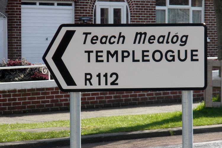
Templeogue (from Irish: Teach Mealóg, meaning "New Church of Saint Mel") is a suburb of southwest Dublin in Ireland. The original Irish language name Teach Mealóg refers to a chapel named after Saint Mel that was built there in about 1273.
Contents
- Map of Templeogue Dublin Ireland
- Development
- Amenities
- Politics and administration
- Population
- Culture
- Notable residents
- References
Map of Templeogue, Dublin, Ireland
Templeogue is surrounded by the adjacent suburbs of Ballyroan, Butterfield, Firhouse, Greenhills, Kimmage, Knocklyon, Limekiln, Old Orchard, Perrystown, Rathfarnham, Tallaght, Terenure, Tymon, and Whitehall. The three main routes through Templeogue are the R112 regional road (Templeville Road), the R137 regional road (Templeogue Road), and the R817 regional road (Cypress Grove Road & Wainsfort Road).
It is 6.0 kilometres (3.7 mi) from both the city centre to the north and the Dublin Mountains to the south, and to the coast at Dublin Bay on the Irish Sea. It is 55m (180 feet) above sea level and occupies an area of 534 hectares. The River Dodder forms the southern border with Rathfarnham while the River Poddle forms the northern border with Greenhills and Kimmage.
Prominent views from Templeogue are of Montpelier Hill 5.7 km (3.5 mi) to the southwest, topped by the ruin of the Hellfire Club at 383m (1,257 feet), and of Three Rock Mountain (450m), topped by transmitter masts 7.3 km (4.5 mi) to the southeast.
Development
Templeogue was originally a small village in the rural, southern part of County Dublin. In Elizabethan times it was owned by the Talbot family, who later became prominent as the owners of Mount Talbot. In the seventeenth and eighteenth centuries it was owned by the Domviles who controlled access to Dublin's main water supply, the River Dodder, which passed through their estates. In 1801, the Templeogue Road was constructed, originally as a toll road. Urban expansion of Dublin during the 1950s and '60s absorbed the village.
Amenities
The local schools are St. Pius X National School, Our Lady's Secondary School, Templeogue College, St Mac Dara's Community College, Bishop Galvin National School, Bishop Shanahan National School, and Ashfield College.
The Roman Catholic parish church is St. Pius X which opened on 27 November 1960 on College Drive. A previous church was situated close to the existing graveyard at Wellington Lane, where the original village of Templeogue was located. In 1975 St. Jude's church was constructed at Orwell Park to serve the newer housing estates of Orwell, Willington, Rossmore and surrounding areas.
Although surrounded by pubs in adjacent neighbourhoods, Templeogue has only one pub inside its boundaries, The Templeogue Inn, also known as The Morgue. In the 19th and early 20th centuries, the Dublin and Blessington Steam Tramway passed through Templeogue so close to the pub that many deaths occurred. Corpses were often sheltered in the pub until taken away and the pub acquired the permanent, morbid nickname. The Templeogue Inn was the most expensive pub in Ireland for a time when it changed hands on 12 October 1983 for IR£660,000, a remarkable sum at the time.
The suburb has many open fields (such as Orwell Green, Glendown Green and Rossmore Green), and sports clubs — Faughs GAA Club, St. Judes GAA Club, St. Mary's College RFC, Templeogue Swimming Club, Templeogue Tennis Club, and Templeogue United Football Club.
Dublin Bus operates the following bus routes through Templeogue: 15, 15B, 15E, 15F, 49, 49A, 49N, 54A, 65, 65B, and 74.
Politics and administration
Templeogue straddles two Dáil constituencies, with five of its electoral divisions (Templeogue-Cypress, Templeogue-Limekiln, Templeogue-Orwell, Templeogue-Osprey, and Templeogue Village) in the Dublin South-West constituency, and one electoral division (Templeogue-Kimmage Manor) is in Dublin South-Central.
It is administered by South Dublin County Council, and its Local Electoral Area for county council elections is Tallaght Central.
Templeogue is part of the Dublin 6W postal district.
Population
Templeogue's population at the 2011 census was 17,378, a fall of 1.8 percent from the previous 2006 census. In the twenty years from 1991–2011, the population fell by 2,269, a decrease of 11.5 percent.
Culture
James Joyce, who was born 2 km to the northeast in Rathgar, mentions Templeogue in Finnegans Wake, Book III, Episode 3, page 553, line 12.
The poet Austin Clarke lived in Bridge House beside Templeogue Bridge which spanned the River Dodder. After his death, there was a proposal to preserve the house and his library of 6,500 books as a memorial. This was not possible owing to long-term plans to demolish the house and widen the road. The old Templeogue Bridge, built in 1800, and Bridge House were removed and a new bridge was opened by Councillor Mrs. Bernie Malone, Chairman Dublin City Council on 11 December 1984, which was renamed Austin Clarke Bridge in his honour.