
Local time Saturday 3:00 AM | ||
 | ||
Weather 1°C, Wind E at 6 km/h, 100% Humidity | ||
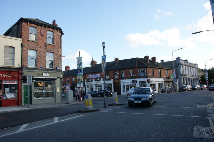
Rathgar dublin ireland
Rathgar (Irish: Ráth Garbh, meaning "rough ringfort"), originally a village, from 1862 part of the township Rathmines and Rathgar, in 1930 became a suburb of Dublin, Ireland. It lies about 3 kilometres south of the city centre.
Contents
- Rathgar dublin ireland
- Map of Rathgar Co Dublin Ireland
- Driving in ireland rathgar road dublin 6
- Location
- History
- Amenities
- Schools
- Business
- Health care
- Churches
- Theological College
- Synagogues
- Convents
- Diplomatic missions
- RSA Driving Test Centre
- Notable people associated with Rathgar
- Politics
- Nearby suburbs
- References
Map of Rathgar, Co. Dublin, Ireland
"[f]rom the back windows of the incongruously named "Yeovil" there was... a clear vista of parklike wooded country and beyond that of the complete ring of the untamed Dublin Mountains. On any clear day one's eye could wander along that amphitheatre of beloved slopes, over Niall Glundubh's cairn on Tibradden, past haunted Kilmashogue, down into the sylvan hollows of Glendhu, up again along a red-brown fringe of leafless trees to the sinister ruins of Kilikee brroding over Dublin's south-western suburbs - "the Hellfire Club," monumental to the arrogance and violence of the eighteenth-century Irish gentry - until finally one's gaze rested upon Seefin, a pearl-grey phantasm of a mountain, its summit gleaming maybe with the snowdrifts of last week's blizzard. And deep in those folded hills, thirty miles away, was hidden Glendalough of the Seven Churches, an enchanted place of holy gloom."
Arnold Bax, Farewell My Youth
Driving in ireland rathgar road dublin 6
Location
Rathgar is situated in south Dublin. It lies beside Rathmines, Terenure, Dartry and Harolds Cross. Other nearby suburbs are Ranelagh, Rathfarnham, Milltown, Kimmage and Crumlin. The Grand Canal lies directly north of Rathgar. The majority of Rathgar lies within the jurisdiction of Dublin City Council, and straddles the postal boundary of Dublin 6.
History
Rathgar, in the Middle Ages, was a farm belonging to the Convent of St Mary de Hogges, at present-day College Green. At the Dissolution of the Monasteries, Rathgar was granted to the Segrave family: they built Rathgar Castle, ownership of which subsequently passed to John Cusack, who was Lord Mayor of Dublin in 1608. The castle remained in the possession of the Cusack family for over a century, but gradually decayed and was a ruin by the end of the eighteenth century. No trace of it remains today: it is thought to have been located at what is now 44-49 Highfield Road.
The village began to develop in the eighteenth century: Rathgar Avenue is probably the oldest street, while Highfield Road was developed in 1753. Zion Church and Christ Church Rathgar were built in the 1860s, by which time Rathgar was a sizeable community.
Amenities
Rathgar is largely a quiet residential suburb with good amenities, including primary and secondary schools, nursing homes, child-care and sports facilities, and good public transport to the city centre. The housing stock largely comprises red-brick late Georgian and Victorian era terraces and much of the area lies within an architectural conservation zone. Dodder Park is located in Rathgar.
Schools
Business
Rathgar has a variety of retail outlets. It maintains a village feel and has a delicatessen, 2 butchers, a bike shop and a wine shop within 20 yards of the main cross. There is also Rathgar Pharmacy, Rathgar Hair Studio and a number of fashion and interior boutiques. There is also a small Supervalu supermarket. Local restaurants include Bijou (Modern Irish), Lumanti of Nepal (Nepalese), Howard's Way and Kanum (Asian).
Health care
St. Luke's Hospital, Highfield Road, specialises in cancer treatments. This is currently under threat of closure and many of the local residents are opposed to this. Mount Carmel General and Maternity hospital was located on Orwell Road but closed in January 2014.
Churches
Rathgar has a number of notable architectural features, notably Christ Church Rathgar (part of the Presbyterian Church in Ireland) at the junction of Rathgar Road and Highfield Road in the village centre. The Roman Catholic Church of The Three Patrons (named after the three Patron Saints of Ireland: St Patrick, St Bridget and St Columba) on Rathgar Road is known as "The Servants' Church" because in the late 19th and early 20th century it was the place of worship for the large number of servants who worked and lived in the large houses in the area.
Theological College
The Church of Ireland Theological College and the Zion Church of Ireland at the junction of Zion and Bushy Park Road are also in Rathgar.
Synagogues
The Dublin Jewish Progressive Congregation (Knesset Orech Chayim) have their Synagogue at 7 Leicester Avenue, Rathgar. Leicester Avenue is a continuation of Kenilworth Square, South. The orthodox Dublin Hebrew Congregation have their synagogue in nearby Terenure
Convents
The Marist Sisters have a convent at 51 Kenilworth Square
Diplomatic missions
The Embassy of the Russian Federation is located in extensive grounds in southern Rathgar, with the Consular Office by the gates.
RSA Driving Test Centre
The Road Safety Authority (RSA) operate driving tests from their premises on Orwell Road. Several of the Rathgar driving test routes cover much of the surrounding area.
Notable people associated with Rathgar
"[f]rom the back windows of the incongruously named "Yeovil" there was... a clear vista of parklike wooded country and beyond that of the complete ring of the untamed Dublin Mountains. On any clear day one's eye could wander along that amphitheatre of beloved slopes, over Niall Glundubh's cairn on Tibradden, past haunted Kilmashogue, down into the sylvan hollows of Glendhu, up again along a red-brown fringe of leafless trees to the sinister ruins of Kilikee brroding over Dublin's south-western suburbs - "the Hellfire Club," monumental to the arrogance and violence of the eighteenth-century Irish gentry - until finally one's gaze rested upon Seefin, a pearl-grey phantasm of a mountain, its summit gleaming maybe with the snowdrifts of last week's blizzard. And deep in those folded hills, thirty miles away, was hidden Glendalough of the Seven Churches, an enchanted place of holy gloom."
Arnold Bax, Farewell My Youth
Politics
Rathgar is located in the Dáil Éireann constituency of Dublin Bay South.