
PIN 532201 Area 13.58 km² Local time Tuesday 3:08 PM | Time zone IST (UTC+5:30) Telephone code 91–8945 Population 28,631 (2011) | |
 | ||
Weather 34°C, Wind S at 26 km/h, 52% Humidity Neighborhoods Rotari Nagar, Sambana Street, Soggadi Peta, Borigipeta, Bapa Reddy Colony | ||
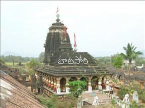
Tekkali is a census town in Srikakulam district of the Indian state of Andhra Pradesh. It is the mandal headquarters of Tekkali mandal in Tekkali revenue division.
Contents
Map of Tekkali, Andhra Pradesh 532201
Etymology
The town derives its name from Telugu word for the medicinal tree Latin: botanical name is Clerodendrum phlomides Linn, of the family Verbenacae, called 'Tekkali' chettu in Telugu. The Tekkali chettu (tree) is known by various alternate names too in various regions of Telugu lands, some of which are: Nelli నెల్లి (from which
(a) Nellore City in Nellore district, southern coastal Andhra Pradesh, and
(b)Nellimarla Town in Vizianagaram district, northern coastal Andhra Pradesh are said to derive their names), and
Tauki is another to name of the same tree, to name a few.
Geography
Tekkali is located at 18.6167°N 83.2333°E / 18.6167; 83.2333. It has an average elevation of 27 meters (91 feet).
Transport
The nearest airport is the Visakhapatnam_Airport, which is at a distance of 150 km. NH-5(chennai-kolkata) passes through the town. It is well connected with the nearest towns of Nandigam, Palasa, Meliaputti, Chapara, Sompeta, Mandasa, Kaviti, Itchapuram, Narasannapeta, Pathapatnam, Paralakhemundi and the district capital Srikakulam. Tekkali is 50 km distance from Srikakulam.
There is a Railway station in Tekkali. Another nearby railway station is at Naupada Jn.(NWP), on the Visakhapatnam to Howrah track. Naupada Jn. is 4 km from Tekkali and has frequent transport facility.
Demography
According to The Imperial Gazetteer of India Tekkali in 1901 was a Zamindari tahsil in Ganjam district of Madras province. It lies on the coast of Bay of Bengal with an area of 275 square miles.
Education
The primary and secondary school education is imparted by government, aided and private schools, under the School Education Department of the state. The medium of instruction followed by different schools are English, Telugu.