
Country Language spoken State District Nellore | Population 378,428 (2001) Area 149.96 km2 Region Coastal Andhra Mayor Abdul Aziz | |
 | ||
Colleges and Universities Vikrama Simhapuri University, Jawahar Bharati College | ||
Map of Nellore
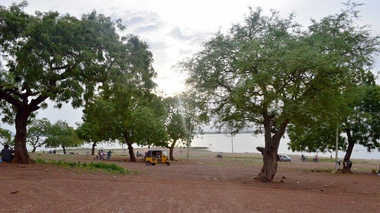
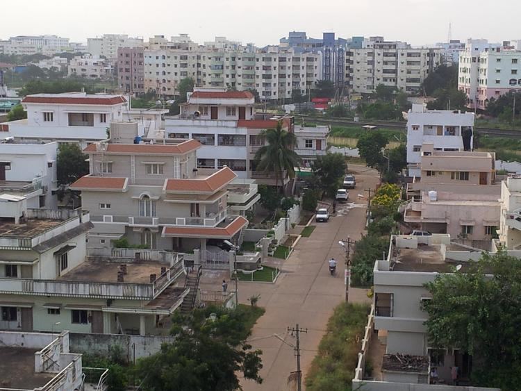
Nellore is a city and district headquarters of Nellore district in the Indian state of Andhra Pradesh. It is located on the banks of Penna River and is the fourth most populous city in the state.
Contents
- Map of Nellore
- Attraction of nellore
- Etymology
- History
- Geography
- Climate
- Demographics
- Governance
- Economy
- Culture
- Transport
- Education
- Media
- Street food chicken pakora nellore special food
- Andhra delicacies that left our highwaymen smacking their lips
- References
Attraction of nellore
Etymology
A mythological story from Sthala Purana depicts, a lingam in the form of a stone under belli tree. The place gradually became Nelli-ooru ("Nelli" in Telugu stands for Tree and ooru in Telugu stands for place) and then to present day Nellore.
History
Nellore had been under the rule of Cholas, Pallavas, pandyas, Maurya Dynasty, Kharavela of Chedi dynasty, Satavahanas, Kakatiyas, Eastern Gangas of Kalinga Empire, Vijayanagara Empire, Arcot Nawabs and other dynasties.
Nellore existed from the times of the Cholas ruled by Rajendra Chola I under Tanjavur Mauryan empire and was ruled by Ashoka in the 3rd century B.C. Nellore was conquered by the Rulers of the Pallava Dynasty and it was under their till the 6th century AD, subsequently the Chola rulers ruled Nellore for a long period of time. The Telugu Cholas met their decline in the 13th Century.Tamil inscriptions indicate that it formed part of Cholas kingdom till their decline in the thirteenth century AD It later became a part of Kakatiyas, Vijayanagara Empire, Sultanate of Golconda, Mughal Empire and Arcot Nawabdom. In the 18th century, Nellore was taken over by the British from the Arcot Nawabs and was part of the Madras Presidency of British India.
The city had an important role in the emergence of the Telugu language and the formation of the state of Andhra Pradesh. Potti Sriramulu, who fasted until death for the formation of Andhra Pradesh, hailed from Nellore.
Geography
Nellore is located at 14.44°N 79.98°E / 14.44; 79.98. It has an average elevation of 18 metres (59 ft).
Climate
The climate of Nellore city is a typical tropical maritime climate, with hot, humid summers and mild winters. April and May are the hottest months and the hot conditions generally last until the end of the June, December, January and February are the coolest months. As the Bay of Bengal is at a distance of 24 kilometres (15 mi) from the city, the sea breeze renders the climate of the city moderate both in winter and in summer. Humidity level in the city is high due to its proximity to the coast. Nellore does not receive the south-west monsoon. Rainfall in Nellore occurs between the months of October and December due to the north-east monsoon. This period gives about 60 percent of the city's annual rainfall. Cyclones are common in the city during this period, causing floods and havoc.
The maximum temperature is 36 to 46 °C (97 to 115 °F) during summer and the minimum temperature is 23 to 25 °C (73 to 77 °F) during winter. The rainfall ranges from 700 to 1,000 mm (28 to 39 in) through South West and North East Monsoons. Nellore is subject both to droughts and to floods based on the seasons. It is also one of the hottest cities in India with at least 35 super hot days in a year.
Demographics
As of 2011 census, Nellore city had a population of 499,576. The average literacy rate stands at 83.59% (male 87.53%; female 79.52%) with 387,192 literates, significantly higher than the state average of 73.00%. The expanded city population post merger of 15 gram panchayats into Nellore Municipal Corporation stands at 600,869.
Governance
Civic administration
Nellore Municipal Corporation was constituted as a municipality on 1 November 1866 by the Madras District Municipality Act. It was upgraded to corporation on 18 October 2004 and has a jurisdictional area of 150.48 km2 (58.10 sq mi) with 54 wards. In 2013, fifteen gram panchayats namely, Allipuram, Ambhapuram, Buja Buja Nellore, Chinthareddypalem, Gudupallipadu, Gundlapalem, Kallurupalli, Kanaparthypadu, Kodurupadu, Narayanareddypeta, Navalakulathota, Nellore Bit-I (Kothuru), Peddacherukuru, Pottipalem, Vavilatepadhu were merged into the municipal corporation. Present mayor of the city is Abdul Aziz.
The city is one among the 31 cities in the state to be a part of water supply and sewerage services mission known as Atal Mission for Rejuvenation and Urban Transformation (AMRUT).
Politics
Nellore is represented by Nellore City assembly constituency and Nellore Rural assembly constituency for Andhra Pradesh Legislative Assembly. Anil Kumar Poluboina is the present MLA of Nellore City assembly constituency representing YSRCP. Kotamreddy Sridhar Reddy is the present MLA of Nellore Rural assembly constituency representing YSRCP.
Economy
Certain industries like Nippo batteries factory, Apache leather shoes factory etc. have their presence. Proximity to the sea and fertile land towards the east have led to agriculture and aquaculture to prosper. The most productive is the Shrimp culturing.
Culture
The annual Rottela Panduga/Rotiyaan ki Eid is an annual urs event celebrated at the Bara Shaheed Dargah(shrine of twelve martyrs) on the banks of Swarnala Cheruvu. The event got its name after the practice of exchanging rotis(flat breads) and attracts visitors from all religious backgrounds.
Economy
A 12,000 acre Special Economic Zone (SEZ) is being set up in the vicinity of the port by the Krishnapatnam Infratech Private Limited, a special purpose vehicle set up by KPCL. The SEZ entails an investment of ₹6,000 crores and is expected to create 30,000 direct employments. The SEZ is being designed by Mahindra Engineering and is to be a multi-product SEZ.
Transport
Local transport in the city include, two, three and four wheelers. Of these, privately operated auto rickshaws accounts to around 6,000, dominating most part of the city for local commuting. Nellore bus station of the city operates district and long distance services. Nellore is classified as an A grade and Adarsh station in the Vijayawada railway division of South Central Railway zone. The city also has two small railway stations namely, Nellore South, Vedayapalem. The Southern Railway operates MEMUs for commuting between Nellore and Chennai Central. There is also a proposal to build a no frills airport for the city.
The city has a total road length of 1,189.95 km (739.40 mi). The proposed Outer Ring Road, existing arterial and internal roads helps reduce traffic congestion. The city is connected with major National highways such as, National Highway 16, a part of Asian Highway 45 and Golden Quadrilateral, bypasses the city.
Education
The primary and secondary school education is imparted by government, aided and private schools of the School Education Department of the state. The medium of instruction followed by different schools are English, Telugu.
Media
Zaminryot newspaper and Lawyar weekly newspaper are based out of Nellore. In addition, Eenadu and Sakshi newspapers are also printing local editions in Nellore.