Samiksha Jaiswal (Editor)

Teesdale Way

Updated on
Edit
Like
Comment
Share on FacebookTweet on TwitterShare on LinkedInShare on Reddit
Teesdale Way steverabonecomEastCoasttoWestCoastsouth35jpg

Teesdale way 1 over the tops


The Teesdale Way is a long distance walk between the North Sea coast of North Yorkshire and the Cumbrian Pennines in England. The walk is 100 miles (160 km) 100 miles / 161 km in length, it links in with other long distance walks such as the Pennine Way and the E2 European Walk between Harwich and Stranraer.

Contents

The Teesdale way ends in Warrenby near Redcar, having passed through the heavily industrialised Teesside area, consisting of Middlesbrough, Stockton-on-Tees and Thornaby-on-Tees. This gives a great insight into the once proud ship building and industrial heritage of the North East.

Between Yarm and Croft-on-Tees the river goes through the meandering lowland section of the Tees Valley. As the river heads downstream Upper Teesdale it passes through the historic settlements of Piercebridge and Barnard Castle.

In Upper Teesdale the walk makes a U-turn at Eggleston Hall, heading down the other side of the dale, back to Barnard Castle.

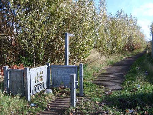
Thornaby and Basleton woods are connected to each other. They are located in Thornaby, in the Borough of Stockton-on-Tees.

At six hectares, Thornaby Woods is a large area of ancient woodland and features trees such as oak, elm and witch. Roe deer have been seen in and around Thornaby and Basleton woods.

Industrial Teesside

  • Teesside Steel Works, Lackenby
  • Riverside Stadium, Middlesbrough
  • Middlesbrough Transporter Bridge
  • Tees Corridor

  • Teessaurus Park
  • Tees Newport Bridge
  • A19 Tees Viaduct
  • Tees Barrage and Teesside White Water Course
  • Infinity Bridge
  • Princess of Wales Bridge
  • Teesquay Millennium Bridge
  • Victoria Bridge
  • Nature reserves

  • Maze Park Nature Reserve, Middlesbrough
  • Black Bobbies Field Nature Reserve, Thornaby-on-Tees
  • Bowesfield Nature Reserve, Thornaby-on-Tees
  • Bassleton Wood, Thornaby-on-Tees
  • Gainford Spa Nature Reserve, Gainford
  • Waterfalls

  • High Cup Nick
  • Cauldron Snout
  • High Force
  • Low Force
  • Museums

  • Great Holme Museum, Eaglescliffe
  • Bowes Museum, Barnard Castle
  • Ruins

  • Medieval village of Newsham
  • Sockburn Church Ruins
  • Castle Hill, Blackwell
  • Baydale Chapel Ruins
  • Gainforth Mill
  • Piercebridge Roman Fort
  • Piercebridge Roman Bridge
  • Mortham Tower, near Greta Bridge
  • Egglestone Abbey
  • Cotherstone Castle
  • Stately homes

  • Rokeby Park, Whorlton
  • Eggleston Hall
  • Village churches

  • St John's Church, Low Dinsdale
  • All Saints Church, Girsby
  • All Saints Church, Hurworth-on-Tees
  • St Peter's Church, Croft-on-Tees
  • St Edwin's Church, Coniscliffe
  • St Mary's Church, Piercebridge
  • St Mary's Church, Gainford
  • St Andrew's Church, Winston
  • St Mary's Church, Whorton
  • St Romald's Church, Romaldkirk
  • Other

  • South Gare
  • Butterfly World, Eaglescliffe
  • Whorlton Lido
  • Deepdale Aqueduct
  • Octagonal Market Cross, Barnard Castle.
  • Settlements

  • Warrenby
  • Dormanstown
  • North Ormesby
  • Middlesbrough
  • Stockton-on-Tees
  • Thornaby-on-Tees
  • Preston-on-Tees
  • Eaglescliffe
  • Yarm
  • Aislaby
  • Low Worsall
  • Middleton One Row
  • Middleton St George
  • Over Dinsdale
  • Low Dinsdale
  • Girsby
  • Sockburn
  • Neasham
  • Hurworth-on-Tees
  • Hurworth Place
  • Croft-on-Tees
  • Stapleton
  • Blackwell
  • Low Coniscliffe
  • Merrybent
  • High Coniscliffe
  • Carlbury
  • Piercebridge
  • Gainford
  • Winston
  • Whorlton
  • Barnard Castle
  • Startforth
  • Romaldkirk
  • (returns to Barnard Castle)

    References

    Teesdale Way Wikipedia