
- elevation 3,120 m (10,236 ft) - average 22 m/s (777 cu ft/s) Discharge 22 m³/s | - location Barda, Azerbaijan Length 200 km Basin area 2,650 km² Mouth Kura | |
 | ||
- location | ||
The Tartar (Armenian: Թարթառ, Azerbaijani: Tərtərçay) is one of the tributaries of the Kura River. It is de jure located in central part of Republic of Azerbaijan, though most of the area where it flows is de facto part of Nagorno-Karabakh Republic.
Contents
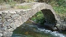
Map of Terter, Azerbaijan
OverviewEdit
Tartar is the left tributary of Kura, the largest river in Caucasus. The river originates in the area where Qonqur, Alaköz and Mıxtökən mountain ranges meet on Karabakh Plateau in the vicinity of hot springs village of Istisu located de jure in Kalbajar Rayon of Azerbaijan and de facto in Martakert Province of Nagorno-Karabakh Republic. The altitude where the river originates from mountain springs is 3,120 m (10,240 ft) above sea level. The river flows eastward through the whole Kalbajar rayon (de facto Martakert Province) passing through Kalbajar city, Tartar and Barda raions passing through Tartar and Barda cities before discharging into Kura. The river has two left Levçay. (36 km (22 mi)) and Ağdabançay (19 km (12 mi)), and one right Turağayçay (35 km (22 mi)) tributaries. Sarsang reservoir was built on Tartar river in 1976 for electricity and irrigation purposes.
Statistical informationEdit
The overall length of the river is 200 km (120 mi), the basin area is 2,650 km2 (1,020 sq mi). Tartarchay is considered one of the water-rich tributaries of Kura within Azerbaijani territory. The water volumes are sourced from rainfall (14%), snow (28%) and underground waters (58%). During spring and summer months, the snow melting in the mountains causes floods making up 65-70% of the annual water flow. In August and September, the water levels decrease. From October until November, the rainfall increases the water levels again. The average annual discharge of the river is 22 m3/s (780 cu ft/s). Average annual flow is 693.8 million m3. The average mineralization of the river is 300-500 mg/l with hydrocarbons and calcium.
Water usesEdit
What was once the famous resort village of Istisu (meaning "Hot Water" in Azerbaijani), which was ruined in the Nagorno Karabakh War, is located on the lower part of the river. The resort contains both natural drinking mineral water and hot water spring for bathing. Most of the area where the river flows is now part of de facto independent Nagorno-Karabakh Republic. Sarsang Hydro Power Plant with capacity of 50 megawatt is operated at the Sarsang reservoir of the river and is the main source of electric energy for Nagorno-Karabakh Republic (40-60%).