
 | ||
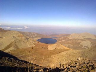
The Karabakh Plateau (Azerbaijani: Qarabağ yaylası; Armenian: Ղարաբաղի բարձրավանդակ translit.: Gharabaghi bardzravandak) is a volcanic plateau of the Lesser Caucasus, in Armenia and Azerbaijan (unrecognized Nagorno-Karabakh Republic). It extends from the south of the Murovdag range towards the East Sevan Range. (The Great Soviet Encyclopedia locates the plateau (Карабахское нагорье) between the Zangezur Mountains and the Karabakh Range.) The Hakari river (Akera, Akari, left tributary of the Aras) separates it form the Karabakh Range. The highest point is Dəlidağ (3616 m). It features a number of extinct volcanoes, the highest being Qızılboğaz (3581 m).
Map of Karabakh Plateau, Azerbaijan
References
Karabakh Plateau Wikipedia(Text) CC BY-SA