
- elevation 43 m (141 ft) - elevation 0 m (0 ft) Founded 20 May 1969 | - location Caribbean Sea Area 2,810 km² | |
 | ||
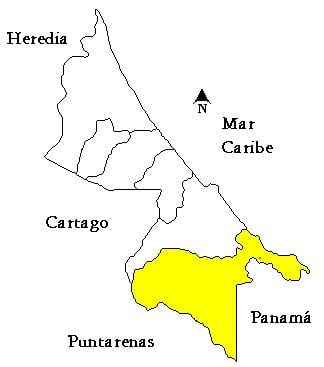
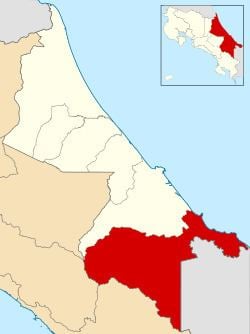
Talamanca is the fourth canton in the province of Limón in Costa Rica. It is the largest of Costa Rica's 81 cantons, covering an area of 2,809.93 km2 (1,084.92 sq mi), and has a population of 32,555. The county is composed of four districts (see graphic below), with its capital city, Bribrí, located in the Bratsi district. Talamanca houses the largest indigenous population in the country (at 11,062, or 34% of the county's population), which is composed principally of the Bribri and Cabécar groups (who in turn represent two of Costa Rica's eight distinct indigenous groups).
Contents
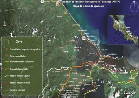
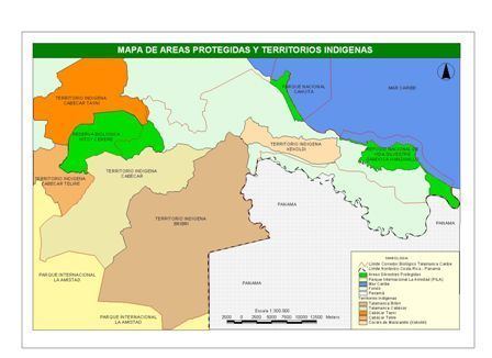
Eight-eight percent of Talamanca's territory is protected. Fifty-five percent of this land falls under the Chiripó, Amistad, and Cahuita National Parks; 31% covers Talamanca's four indigenous reserves (Kekoldi, Talamanca Bribrí, Talamanca Cabécar, and Telire); and 2% belongs to the Refugio de Vida Silvestre Gandoca Manzanillo national "reserve" (a major tortoise breeding ground).
The Costa Rican government is highly aggressive (albeit a bit slow to act) in its protection of these lands. On July 27, 2011, for example, the Ministerio de Ambiente, Energía y Telecomunicaciones (Minaet) carried out the demolition of two hotels (Las Palmas and Suerre), due to their occupation of 4 hectares of land within the Refugio de Vida Silvestre Gandoca Manzanillo. This demolition was the culmination of events starting in 1993, when Minaet revoked these hotels' permission of occupation.
The county suffers from pervasive poverty. As of 2009, its human-development index is the lowest-ranked of all Costa Rican cantons. While its most recent infant mortality rate is 12.89% (2009), it was as high as 22.5% (2003), and stayed above 15% between 2003 and 2007. As of 2010, 52.3% of Talamanca inhabitants have access to sanitation (either piped or septic tank), and 75.2% are connected to electricity.
Talamanca contains one of Costa Rica's three official border-crossing points (Sixaola-Guabito). The county is noted for its beautiful beaches, especially in Cahuita and Puerto Viejo (Old Harbor), which are popular tourist locations.
Districts
The canton of Talamanca is subdivided into four districts (distritos):
History
The canton was established by law on May 20, 1969.