
Elevation 1,050 m Area code 0382 | Time zone EET (UTC+2) Population 2,746 (2009) | |
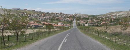 | ||
Taşpınar is a belde (town) in Aksaray Province, Turkey.
Contents
- Map of 68000 TaC59FpC4B1nar Belediyesi2FAksaray Merkez2FAksaray Turkey
- Geography
- History
- Economy
- Transportation
- References
Map of 68000 Ta%C5%9Fp%C4%B1nar Belediyesi%2FAksaray Merkez%2FAksaray, Turkey
Geography
Taşpınar is in the Anatolian plateau, just west of Mount Hasan. The coordinates of the midtown can be given as 38°10′40″N 34°01′30″E The average altitude is 1,050 metres (3,440 ft). The population is 2746 (As of 2009)
History
The earliest residents of the village were the members of a tribe from Azerbaijan in 1515. Eventually, people from nearby villages also settled in Taşpınar. Meanwhile a group of Taşpınar residents chose to live in Hotamış, another town roughly 100 kilometres (62 mi) south west of Taşpınar. In 1957 Taşpınar was declared a seat of township.
Economy
The main economic activity is handmade rugs. Taşpınar rugs are especially famous for their high density of knots. (40·40 in 10 cm² or more in older rugs.) Although the town is situated in a volcanic plateau which is supposed to be fertile, because of the low annual rainfall, agricultural income is limited. Some Taşpınar residents work in the light industry of nearby Aksaray.
Transportation
Taşpınar is 27 kilometres (17 mi) south of Aksaray on the main highway , from Ankara to Adana, which makes it almost the midpoint of D 90 high way.