
Time zone CET (UTC+1) Area 53.91 km² Local time Monday 11:12 PM | Postal code 6646 Population 1,712 (2015) Area code 63 | |
 | ||
Weather 5°C, Wind W at 5 km/h, 55% Humidity | ||
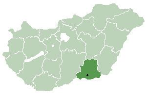
Tömörkény is a village near the town of Csongrád in Csongrád county, in the Southern Great Plain region of southern Hungary.
Contents
Map of T%C3%B6m%C3%B6rk%C3%A9ny, 6646 Hungary
Geography
It covers an area of 53.91 km2 (21 sq mi) and in 2015 had a population of 1,712.
History
The first settlement was built by the Sarmatas and the Avars. There was some cemetery and iron working equipment found. It first legal sign from the 11th century, named "Temerken". In Turkish times, a small fortress defended the local people. The old village was a harbor to move through the Tisza River. Nowadays, it is a typical agricultural village.
References
Tömörkény Wikipedia(Text) CC BY-SA