
 | ||
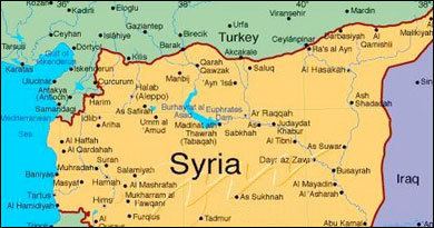
The border between the Syrian Arab Republic and the Republic of Turkey is about 822 kilometres (511 mi) long. It runs across Upper Mesopotamia for some 400 km, crossing the Euphrates reaching as far as the Tigris, following the Southern Turkish stretch of the Baghdad Railway roughly along the 37th parallel between the 37th and 42nd eastern meridians. In the west, it surrounds the Turkish Hatay Province, following the course of the Orontes River and reaching the Mediterranean coast at the foot of Jebel Aqra.
Contents
History
The current Syro-Turkish border was established in the Partitioning of the Ottoman Empire after World War I, based on the Sykes–Picot Agreement between United Kingdom and France in 1916. It was the northern border of the State of Aleppo and later the State of Syria during the 1920s, and the Syrian Republic followed by the short-lived United Arab Republic during the 1930s to 1950s and since 1961 has been the border between the modern states of Syria and Turkey.
The approximate line of most of the border was set by the Treaty of Ankara in 1921. It was delimited more precisely between Meidan Ekbis and Nusaybin in 1926, and between Nusaybin and the tripoint with Iraq in 1929. A special case is the Turkish Hatay Province, which remained autonomous until 1923, then became part of Syria as the Sanjak of Alexandretta (Franco-Syrian Treaty of Independence (1936)), briefly became independent as the Hatay State in 1938 before being annexed by Turkey as the Hatay Province in 1939. The new international border was demarcated by a Franco-Turkish commission in 1938/9, with a protocol of 3 May 1939 mentioning 448 boundary markers placed in numerical order, and an additional protocol signed in Antioch on 19 May 1939 mentioning some additional markers. Some further changes were made in an agreement signed in Ankara on 23 June 1939.
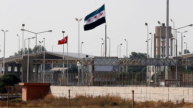
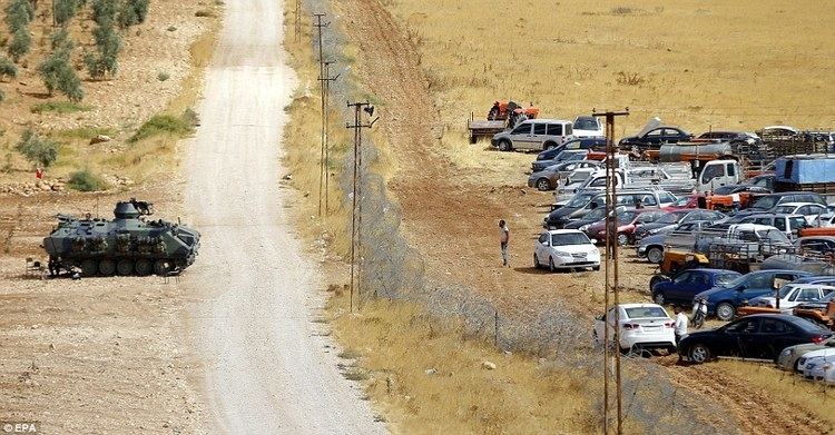
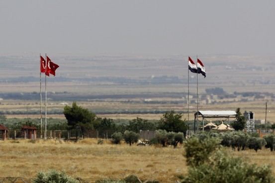
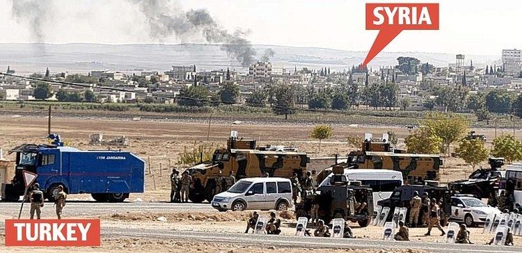
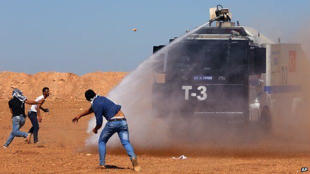
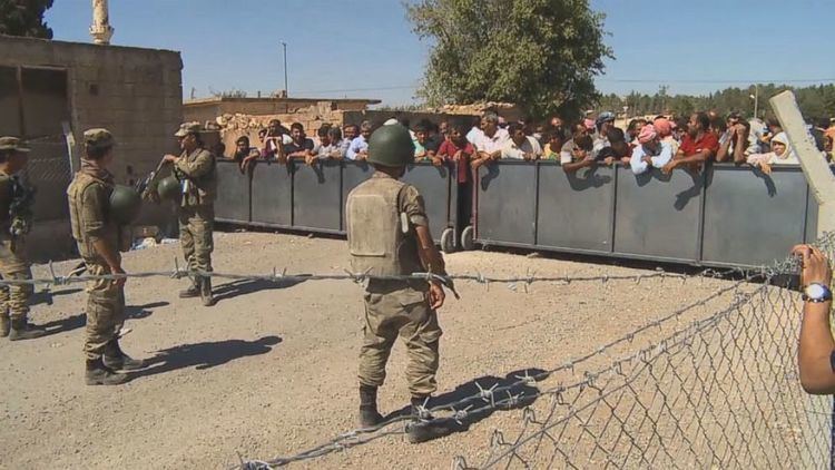
Because of Turkey's membership in NATO (1952) and OSCE (1973), its border to Syria also forms an outer border of these organisations. Since the Syrian Civil War broke out in 2011, tensions across the border have increased, and there have been a number of clashes; there has also been a substantial influx of refugees across the border to Turkey. Turkey began construction of a border barrier in 2014.
Geography
Due to the annexation of the Hatay Province, the post-1939 Syrian-Turkish border touches the Mediterranean coast at Ras al-Bassit, south of Mount Aqra (35.9288°N 35.9178°E / 35.9288; 35.9178). The Hatay province borders the Syrian Latakia and Idlib governorates. The westernmost (and southernmost) border crossing is at 35.905°N 36.010°E / 35.905; 36.010, some 3 km west of Yayladağı. The border reaches its southernmost point at 35.808°N 36.152°E / 35.808; 36.152, 2 km west of Bidama, to include the now-abandoned village of Topraktutan (Beysun) in Hatay.
The border now runs north and east, following the Orontes River for a part of its course, where in 2011 construction of a Syria–Turkey Friendship Dam began (but has since been delayed due to the Syrian civil war), and east to the Bab al-Hawa Border Crossing on the İskenderun–Aleppo road, then further north to the border between Hatay and Gaziantep Province, where it turns sharply east outside of Meidan Ekbis (Afrin District), at 36.830°N 36.665°E / 36.830; 36.665.
With the exception of the Hatay province, the Turkish side of the border is entirely within the Southeastern Anatolia Region. East of Meidan Ekbis, the border stretches eastward for some 400 km, roughly following the 37th parallel north and passing the 37th to 42nd meridians, to the Turkish-Syrian-Iraqi tripoint on the Tigris River. On the Turkish side, the European route E90 runs alongside the length the border, crossing the Euphrates at Birecik and the Tigris at Cizre.
The Syrian Aleppo Governorate has a 221 kilometres (137 mi) long northern boundary with the Turkish Kilis, Gaziantep, and Şanlıurfa provinces.
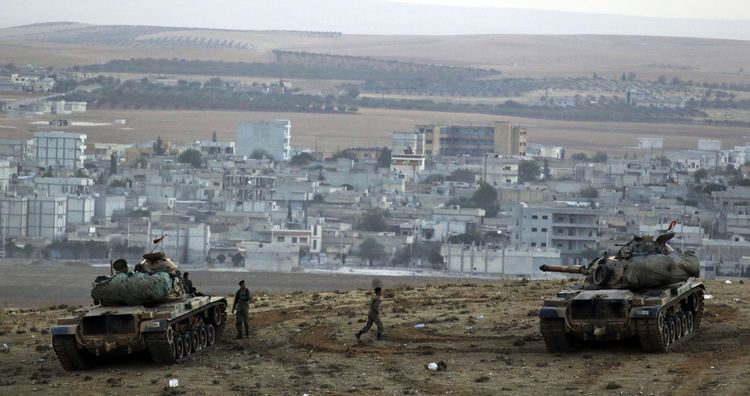
For a significant distance, from Çobanbey to Nusaybin the border follows the tracks of the Konya-Baghdad Railway. It crosses the Euphrates River at Jarabulus/Karkamış and passes north of the border town of Kobanî (Ayn al Arab) (built in 1912 as part of the Baghdad Railway construction project). The Raqqa Governorate's Tell Abyad District borders the Turkish Şanlıurfa Province, including the divided border town of Tell Abyad/Akçakale. The Al-Hasakah Governorate, still bordering Şanlıurfa Province, has a border crossing at Ras al-Ayn, connecting to Ceylanpınar. Some 100 km east of Ceylanpınar, the border passes the border town of Nusaybin in the Turkish Mardin Province (ancient Nisibis, the birthplace of Ephraim the Syrian), next to Syrian Qamishli. After another 100 km it finally reaches the Tigris River south of Cizre.
For the final 30 km, the border now follows the course of the Tigris, turning towards the south-east, until it reaches the Syrian-Turkish-Iraqi triple-point at 37.106°N 42.355°E / 37.106; 42.355.
Border crossings
From west to east: