
Manatiq (Districts) 4 ISO 3166 code SY-LA Population 1.89 million (2014) | Time zone EET (UTC+2) Area 2,297 km² University Tishreen University | |
 | ||
Points of interest Citadel of Salah Ed‑Din, The Blue Beach, National Museum, Syrian Coastal Mountain | ||
Latakia Governorate (Arabic: مُحافظة اللاذقية / ALA-LC: Muḥāfaẓat al-Lādhiqīyah) is one of the fourteen governorates (provinces) of Syria. It is situated in western Syria, bordering Turkey. Its reported area varies in different sources from 2,297 km² to 2,437 km². The governorate has a population of 991,000 (2010 estimate). Members of the Alawite sect form a majority in the governorate, although Armenians, Turkmen, and Sunni Arabs form the majorities in the Kessab, Jabal Turkman, and Jabal al-Akrad regions respectively. The capital of Latakia had, by 2010 estimates, 400,000 inhabitants, 50% of whom were Alawites, 30% were Sunni, and 20% Christian.
Contents
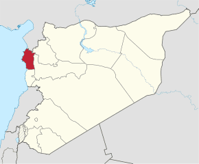
Map of Latakia, Syria
History
The governorate was historically part of the Alawite State, which existed from 1920–1936. The city of Latakia was the capital of the state.
The region has been relatively peaceful since the beginning of the Syrian civil war in 2011. However, the Syrian rebels have had a consistent presence in the northeastern mountains.
Districts
The governorate is divided into four districts (manatiq):
These are further divided into 22 sub-districts (nawahi).
Geography
East of the coastal plains, the governorate is covered by the An-Nusayriyah Mountains.
Latakia is traversed (twice) by the northeasterly line of equal latitude and longitude.