Samiksha Jaiswal (Editor)

Sunrise Trail

Updated on
Edit
Like
Comment
Share on FacebookTweet on TwitterShare on LinkedInShare on Reddit
Province
  
Nova Scotia

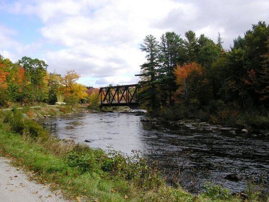
Sunrise Trail httpsmediacdntripadvisorcommediaphotos03

The Sunrise Trail is a scenic roadway in the Canadian province of Nova Scotia.

Contents

Map of Sunrise Trail, Cumberland, Subd. C, NS, Canada

It is located along the province's North Shore on the Northumberland Strait for 316 km (196 mi) from Amherst to the Canso Causeway.

Routes

  • Trunk 4
  • Trunk 6
  • Route 245
  • Route 337
  • Route 366
  • Highway 104
  • Highway 106
  • Trans-Canada Highway
  • Communities

  • Amherst
  • Tidnish Bridge
  • Tidnish
  • Lorneville
  • Port Howe
  • Pugwash
  • Wallace
  • Malagash
  • Tatamagouche
  • River John
  • Caribou
  • Northumberland Ferries
  • Pictou
  • New Glasgow
  • Westville
  • Antigonish
  • Doctors Brook
  • Lower Barney's River
  • Morristown
  • Cape George
  • Georgeville
  • Malignant Cove
  • Tracadie
  • Havre Boucher
  • Auld's Cove
  • Canso Causeway
  • Parks

  • Amherst Shore Provincial Park
  • Arisaig
  • Bayfield Beach
  • Caribou/Munroes Island Provincial Park
  • Fox Harbour Beach
  • Gulf Shore Beach
  • Heather Beach
  • Melmerby Beach
  • Nelson Memorial Provincial Park
  • Northport Beach
  • Powells Point
  • Pomquet Beach
  • Rushtons Beach
  • Tatamagouche Provincial Park
  • Tidnish Dock Provincial Park
  • Waterside Beach
  • Exit list

    for Exit list of the Sunrise Trail see Nova Scotia Highway 104 #Exit list.

    References

    Sunrise Trail Wikipedia