
Existed: 1970 – present | Length 322 km | |
 | ||
East end: Trunk 4 near St. Peter's | ||
Nova scotia highway 104 trans canada antigonish to truro nova scotia
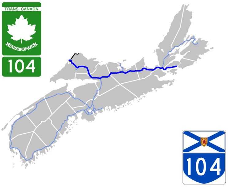
Highway 104 in Nova Scotia, Canada, runs from Fort Lawrence at the New Brunswick border near Amherst to River Tillard near St. Peter's. Except for the portion on Cape Breton Island between Port Hawkesbury and St. Peter's, it is part of the Trans-Canada Highway.
Contents
- Nova scotia highway 104 trans canada antigonish to truro nova scotia
- Map of NS 104 Nova Scotia Canada
- Route
- Exit list
- References
Map of NS-104, Nova Scotia, Canada
Highway 104 mostly supplants the former route of Trunk 4. In 1970, all sections of Trunk 4 west of New Glasgow were renumbered, although the number was added back in the Mount Thom and Wentworth Valley areas in the 1990s when new alignments of Highway 104 opened to traffic.
The provincial government named the highway the Miners Memorial Highway on 8 September 2008 one month before the 50th anniversary of the Springhill Mining Disaster of 23 October 1958.
Route
The highway's present alignment measures 322 kilometres (200 mi) long, of which the western 180 km (110 mi) between the inter-provincial border with New Brunswick at Fort Lawrence through to Sutherlands River is a 4-lane divided freeway. The eastern 142 kilometres (88 mi) from Sutherlands River to River Tillard is a mixture of 2-lane controlled access freeway known as a Super 2, uncontrolled access 2-lane highway, and 4-lane divided freeway sections.
From the inter-provincial border at Fort Lawrence, the highway runs east for 48 kilometres (30 mi) past the towns of Amherst and Oxford to Thomson Station. This section had been built in the 1960s as a Super 2 and was upgraded to a 4-lane divided freeway that opened in 1993. It has a posted speed limit of 110 kilometres per hour (68 mph).
From Thomson Station the highway runs southeast for 45 kilometres (28 mi) to Masstown as a 4-lane divided freeway. This segment is a tolled section known as the Cobequid Pass, which opened on 15 November 1997. It has a posted speed limit of 110 kilometres per hour (68 mph) throughout, except for a posted speed limit of 50 kilometres per hour (31 mph) between KM 72 and 73 at the toll booth.
From Masstown, the highway runs east and northeast for 87 kilometres (54 mi) past the towns of Truro, Westville, Stellarton and New Glasgow to Sutherlands River. This section is a 4-lane divided freeway and has a posted speed limit of 110 kilometres per hour (68 mph). It was upgraded in various stages as follows:
From the end of the 4-lane divided freeway section at Sutherlands River, the highway runs east for 17 kilometres (11 mi) to Barney's River Station. This section was built between 1964 and 1965 as a Super 2 and remains as a controlled access highway with dedicated passing lanes and has a posted speed limit of 100 kilometres per hour (62 mph).
From the end of the Super 2 section at Barney's River Station, the highway runs southeast for 12 kilometres (7.5 mi) to James River. This section had been built in between 1964 and 1965 as an uncontrolled access highway (formerly Trunk 4) and remains as an uncontrolled access highway with a posted speed limit of 100 kilometres per hour (62 mph).
From the end of the uncontrolled access section at James River, the highway runs east for 12 kilometres (7.5 mi) to Addington Forks. This section was built between 1964 and 1965 as a Super 2 and remains as a controlled access highway with a posted speed limit of 100 kilometres per hour (62 mph).
From the end of the Super 2 section at Addington Forks, the highway runs east for 11 kilometres (6.8 mi) to South River Road. This section was built as a new alignment of 4-lane divided freeway that opened on 19 September 2012 and has a posted speed limit of 100 kilometres per hour (62 mph). Prior to this new alignment opening, Highway 104 ran east on the present alignment of Trunk 4 and Post Road in the town of Antigonish and included three intersections controlled by traffic lights.
A new 4-lane divided freeway section opened at South River Road, on October 22, 2016 and has a posted speed limit of 100 kilometres per hour (62 mph).. The highway runs east for 7 kilometres (4.3 mi) to Dagger Woods. Prior to this new alignment opening, this section was an uncontrolled access highway (formerly Trunk 4).
From the end of the freeway section at Dagger Woods, the highway runs east for 4 kilometres (2.5 mi) to Pomquet Forks. This section was built in the 1960s as a Super 2 and remains as a controlled access highway with a posted speed limit of 100 kilometres per hour (62 mph), although there are several at-grade intersections.
From the end of the Super 2 section at Pomquet Forks, the highway runs east for 3 kilometres (1.9 mi) to Heatherton. This section had been built in 1954 as an uncontrolled access highway (formerly Trunk 4) and remains as an uncontrolled access highway with a posted speed limit of 90 kilometres per hour (56 mph).
From the end of the uncontrolled access section at Heatherton, the highway runs east for 29 kilometres (18 mi) to the western end of Auld's Cove. This section was built between 1965 and 1969 as a Super 2 and remains as a controlled access highway with a posted speed limit of 100 kilometres per hour (62 mph).
From the end of the Super 2 section at the western end of Auld's Cove, the highway runs east for 3 kilometres (1.9 mi) to the western end of the Canso Causeway. This section had been built in the 1960s as an uncontrolled access highway (formerly Trunk 4) and remains as an uncontrolled access highway with a posted speed limit of 70 kilometres per hour (43 mph).
From the end of the uncontrolled access section at the eastern end of Auld's Cove, the highway runs east for 2 kilometres (1.2 mi) across the Strait of Canso on the Canso Causeway to Port Hastings. This section was opened in 1955 as a controlled access highway and has a posted speed limit of 70 kilometres per hour (43 mph).
At Port Hastings, the speed limit drops to 70 kilometres per hour (43 mph) approaching a roundabout where the highway interchanges with Trunk 4, Trunk 19 and Highway 105. Highway 105 proceeds east carrying the Trans-Canada Highway designation.
From the roundabout at Port Hastings, the highway is unsigned for 12 kilometres (7.5 mi) as it follows Trunk 4 through Port Hastings and the town of Port Hawkesbury. The posted speed limit is 50 kilometres per hour (31 mph) and includes multiple intersections controlled by traffic lights. The highway reappears at the Exit 43 interchange for Trunk 4 in Melville (just north of Port Hawkesbury).
A Highway 104 bypass from Port Hastings to Melville has been proposed in the past. Concept designs have shown a new alignment of 4-lane freeway being built around the northwest side of Port Hastings, crossing Highway 105 at a new interchange near an electrical substation. The new alignment of Highway 104 would proceed east and then southeast approximately following a power line corridor to the Exit 43 interchange in Melville.
From the end of the uncontrolled access/unsigned section at Melville (just outside Port Hawkesbury), the highway runs east for 34 kilometres (21 mi) to its current eastern terminus at an at-grade interchange with Trunk 4 in River Tillard (near St. Peters). This section was built in the 1970s as a Super 2 and remains as a controlled access highway with a posted speed limit of 100 kilometres per hour (62 mph).
An extension of Highway 104 from River Tillard to Sydney River has been proposed in the past. The Nova Scotia provincial government has designated the entire length of Highway 104 from Fort Lawrence to River Tillard as a "strategic highway" to qualify for federal cost-sharing of maintenance and future upgrades. This designation has also been applied to the remaining Trunk 4 corridor in Cape Breton along the south shore of Bras d'Or Lake from St. Peters to Sydney River. It is eventually envisioned that the Trans-Canada Highway will follow the entire length of Highway 104 from Amherst to Sydney River as a 4-lane freeway, upgraded from the existing two-lane freeway and uncontrolled access sections of the highway.
Exit list
Kilometre distances are approximate.