
 | ||
Sunda trench
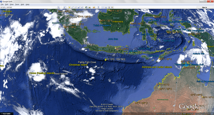
The Sunda Trench, earlier known as, and sometimes still indicated as the Java Trench, is located in the northeastern Indian Ocean, with a length of 3,200 kilometres (2,000 mi). The maximum depth of 7,725 metres (25,344 ft) (at 10°19'S, 109°58'E, about 320 km south of Yogyakarta), is the deepest point in the Indian Ocean. The trench stretches from the Lesser Sunda Islands past Java, around the southern coast of Sumatra on to the Andaman Islands, and forms the boundary between Indo-Australian Plate and Eurasian plate (more specifically, Sunda Plate). The trench is considered to be part of the Pacific Ring of Fire as well as one of a ring of oceanic trenches around the northern edges of the Australian Plate.
Contents
- Sunda trench
- Find 815 chapter 1 1 pinpointing sunda trench
- Characteristics
- Exploration
- Associated seismicity
- Sumatra segment
- Java segment
- References
There is scientific evidence that the 2004 earthquake activity in the area of the Java Trench could lead to further catastrophic shifting within a relatively short period of time, perhaps less than a decade. This threat has resulted in international agreements to establish a tsunami warning system in place along the Indian Ocean coast.
Find 815 chapter 1 1 pinpointing sunda trench
Characteristics
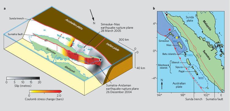
For about half its length, off of Sumatra, it is divided into two parallel troughs by an underwater ridge, and much of the trench is at least partially filled with sediments. Mappings after the 2004 Indian Ocean earthquake of the plate boundary showed resemblance to suspension bridge cables, with peaks and sags, indicative of asperity and locked faults, instead of the traditional wedge shape expected.
Exploration
Some of the earliest exploration of the Trench occurred in the late 1950s when Robert Fisher, Research Geologist at the Scripps Institution of Oceanography, investigated the trench as part of a worldwide scientific field exploration of the world's ocean floor and sub-oceanic crustal-structure. Bomb-sounding, echo-train analysis and manometer were some of the techniques used to determine the depth of the trench. The research contributed to an understanding of the subduction characteristic of the Pacific margins. Various agencies have explored the trench in the aftermath of the 2004 earthquake, and these explorations have revealed extensive changes in the ocean floor.
Associated seismicity
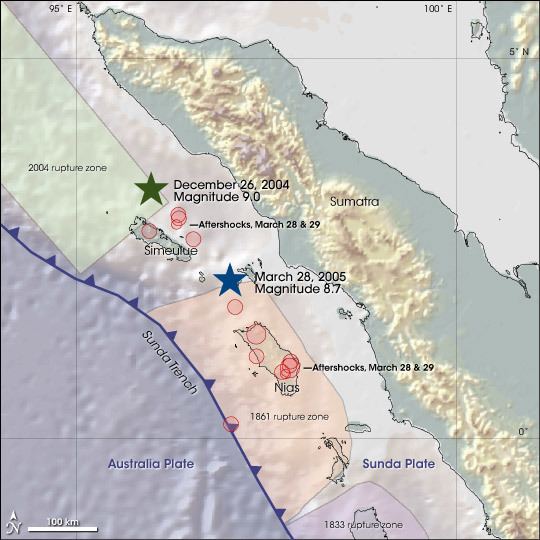
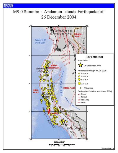
The subduction of the Indo-Australian Plate beneath a bloc of the Eurasian Plate is associated with numerous earthquakes. Several of these earthquakes are notable for their size, associated tsunamis, and/or the number of fatalities they caused.