
Construction began 1960 Area 10.93 km² Height 119 m | Opening date 1966 Surface elevation 501 m Length 695 m | |
 | ||
Operator(s) U.S. Army Corps of Engineers, Huntington District Similar Carnifex Ferry Battlefield, Hawks Nest State Park, New River, New River Gorge Bridge, Stonewall Jackson Lake Stat | ||
Summersville lake west virginia long point cliff jump gopro hd
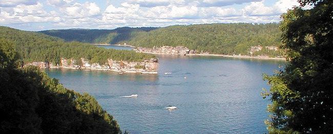
Summersville Lake is a reservoir located in the US state of West Virginia. The lake is formed by a rock-fill dam (Summersville Dam) on the Gauley River, south of Summersville in Nicholas County. It is the largest lake in West Virginia, with 2,700 acres (1,100 ha) of water and over 60 miles (97 km) of shoreline at the summer pool water level. Its maximum depth is 327 feet.
Contents
- Summersville lake west virginia long point cliff jump gopro hd
- Map of Summersville Lake West Virginia USA
- DamEdit
- Hydroelectric projectEdit
- RecreationEdit
- LighthouseEdit
- References
Map of Summersville Lake, West Virginia, USA
DamEdit
The lake was constructed between 1960 and 1966 by the United States Army Corps of Engineers in order to control flooding in an 803-square-mile (2,080 km2) watershed along the Gauley River and the Kanawha River. At 390 feet (120 m) tall, 2,280 feet (690 m) long, and containing 12,000,000 cubic yards (9,200,000 m3) of dirt and rock, the dam itself is the second-largest rock-fill dam in the Eastern United States. President Lyndon B. Johnson dedicated both the dam and a new Summersville Post Office on September 3, 1966.
The US Corps of Engineers broke a long-standing tradition in naming what was called the Summersville Project. Tradition holds that the project will be named after the town nearest the site of construction, unless named for a person (such as Hoover Dam). However, the town of Summersville was not the one nearest the dam. The village of Gad (located near the present-day marina) was literally flooded at the opening of the reservoir. After briefly considering the name "Gad Dam," it was instead decided to name the project after the next nearest town – Summersville.
Hydroelectric projectEdit
In 2001, a two-year project was completed to harness the dam outflow for hydroelectric power generation. The power plant has a capacity to generate 80-megawatts of electricity at peak flow. The thunderous noise caused by the plumes of water that formerly sounded from the base of Summersville Dam have been replaced by the quiet hum of electric generators.
RecreationEdit
The lake also serves as a recreation area for fishing, boating, and rock climbing, as well as snorkeling and scuba diving. It serves as the eastern (upstream) end of Gauley River National Recreation Area. There is a small boat under the lake that was intentionally sunk to give divers something to view while scuba diving.
LighthouseEdit
The Summerville Lake Lighthouse was constructed in 2012 in Mount Nebo by recycling a wind turbine that otherwise would have likely been scrapped. Standing at 2,164 feet above sea level this makes it one of the highest lighthouses above sea level in the world, it is an active aid to aeronautical navigation but is open to the public