District Sukma district Telephone code 07864-284001 Elevation 197 m | Time zone IST (UTC+5:30) Vehicle registration CG Local time Friday 4:39 AM | |
 | ||
Weather 26°C, Wind W at 3 km/h, 78% Humidity | ||
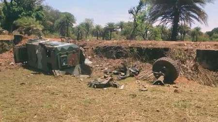
India 360 last rites given to martyrs of sukma ambush
Sukma is a town in the newly formed, southernmost Sukma district in Chhattisgarh [South Bastar Region], India.
Contents
- India 360 last rites given to martyrs of sukma ambush
- Map of Sukma Chhattisgarh 494111
- Geography
- Location
- Transport
- References
Map of Sukma, Chhattisgarh 494111
Geography
It is located at 18°24′0″N 81°40′0″E at an elevation of 197 m above MSL.
Location
Sukma is connected to Jagdalpur by National Highway 30.
Transport
Main and only transport system available is of road transport.Buses play a major role in public transportation.Buses are available for Raipur, Hyderabad, Bhilai, Bilaspur, Vijaywada, Jagdalpur, Visakhapatnam.Nearest rail head is Dantewada.Nearest airport is Visakhapatnam. Other than buses Jeeps and Taxis are other modes of transports available.
References
Sukma Wikipedia(Text) CC BY-SA
