
Country | Capital | |
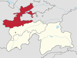 | ||
Map of Sughd Region
Sughd Region (Tajik: Вилояти Суғд Viloyati Suğd/Vilojati Suƣd; Persian: Velâyate soqd ولایت سغد, transliterated as Sogdia Province) is one of the four administrative divisions and one of the three provinces (Tajik: вилоятҳо, viloyatho) that make up Tajikistan. Centered in the historical Sogdiana, it is located in the northwest of the country, with an area of some 25,400 square kilometers and a population of 2,132,100 (2008 est.), up from 1,870,000 according to the 2000 census and 1,558,000 in 1989. It was founded in 1924 as part of Uzbek SSR and became part of Tajik SSR in 1929 after efforts of Shirinsho Shotemur.
Contents
- Map of Sughd Region
- Economy
- Towns
- Districts
- Northern districts of Sughd
- Southern districts of Sughd Zeravshan Valley
- References

The region shares a border with the Jizakh, Namangan, Samarkand and Fergana provinces of Uzbekistan, and the Osh and Batken regions of Kyrgyzstan. The Syr Darya river flows through it. It contains the Akash Massif and Mogoltau Massif Important Bird Areas. Sughd is separated from the rest of Tajikistan by the Gissar Range (passes may be closed in winter). The southern part of the province is the east-west valley of the upper Zarafshan River. North, over the Turkestan Range, is the Ferghana Valley. The province has 30% of Tajikistan's population and one-third of its arable land. It produces two thirds of the country's GDP.
It was known as Leninabad until 1991, then Leninobod until 2000, then Sogd until 2004.
Economy
The economy of Sughd has been growing steadily since 2000, at the average rate of 13.2% in 2008 and 13.3% in 2009. In 2009, farming, trade and industrial production contributed 28.2%, 25.8% and 14.0% to the GRP (gross regional product) of Sughd, respectively. Since 2000, the output of industrial production increased two-fold, at an average annual growth rate of 5–8%.
A free economic zone has been established in the region called Sughd Free Economic Zone.
Towns
The capital is Khujand (formerly Leninabad), with a population of 155,900 (2008 est.). Other major towns include:
Districts
The region is divided into 14 districts (Tajik: ноҳия, nohiya or Russian: район, raion).
Northern districts of Sughd
- Asht District
- Ghafurov District
- Ghonchi District
- Zafarobod District
- Istaravshan (Ura-Tyube) District
- Isfara District
- Konibodom District
- Mastchoh District
- Spitamen District
- Rasulov (Jabbor Rasulov) District
- Shahriston District
Southern districts of Sughd (Zeravshan Valley)
- Ayni (Aini) District
- Kuhistoni Mastchoh District
- Panjakent District