
Country Population 25.2 / km2 | Capital | |
 | ||
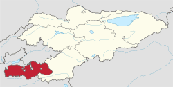
Map of Batken Region
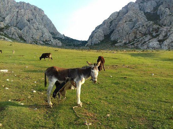
Batken Region (Kyrgyz: Баткен облусу, Batken oblusu; Russian: Баткенская область) is a region (oblast) of Kyrgyzstan. Its capital is Batken. It is bounded on the east by Osh Region, on the south, west and north by Tajikistan, and on the northeast by Uzbekistan. The northern part of the region is part of the flat, agricultural Ferghana Valley. The land rises southward to the mountains on the southern border: the Alay Mountains in the east, and the Turkestan Range in the west.
Contents
- Map of Batken Region
- Rehabilitation and protection of the moon flower in batken regionkyrgyzstan wmv
- Basic Socio Economic Indicators
- Demographics
- Ethnic composition
- Subdivisions of Batken Region
- Enclaves and exclaves
- Travel
- References
The population of the region was reported as 380,256 by the census of 2009. Of them, 24.2 per cent lived in the region's four towns and five urban-type settlements, and 75.8 per cent in the rural areas. The majority (76.5 per cent) of the regione's population are Kyrgyz; there are also Uzbeks (14.7 per cent) and Tajiks (6.9 per cent), as well as a few Russians (0.8 per cent), Tatars (0.4 per cent), and Turks (0.2 per cent).
Batken Region was created on 12 October 1999, from the westernmost section of Osh Region. This was partly in response to the activities of the Islamic Movement for Uzbekistan (IMU), with bases in Tajikistan. In 1999 they kidnapped a group of Japanese geologists and in 2000 some American climbers. In the two years, 49 Kyrgyz soldiers were killed. There have been no incidents since, except for an attack on a Tajik border post in May 2006, which was probably connected to drug running.
Rehabilitation and protection of the moon flower in batken regionkyrgyzstan wmv
Basic Socio-Economic Indicators
Demographics
As of 2009, Batken Region contained 4 towns, 5 urban-type settlements, and 198 villages. Its population, according to the Population and Housing Census of 2009 amounted to 380.3 thousand (enumerated de facto population) or 428.6 thousand (de jure population).
Ethnic composition
According to the 2009 Census, the ethnic composition of the Batken Region (de jure population) was:
Subdivisions of Batken Region
Batken Region is divided administratively into 3 districts:
There are four towns in Batken oblast: Batken, Isfana, Kyzyl-Kiya and Sulyukta. There are five urban-type settlements, including Chauvay, Khaidarkan, Sovetskiy, Kadamjay and Vostochny.
Enclaves and exclaves
In the Soviet period a number of enclaves and exclaves were established in the Batken area.
So'x (or Sokh) (40°02′39″N 71°05′39″E) is an exclave of Uzbekistan, about 24 kilometres east of Batken. The largest of the exclaves, it has an area of ~234 square kilometres, stretches from 3 to 13 kilometres from east to west, and about 35 kilometres north to south, and is crossed by the main highway from Batken to Osh. Tajiks comprise 99 per cent of the population, which in 1993 numbered 42,800.
Chon-Qora and Qalacha (not to be confused with Qal'acha), immediately north of So'x, are the two Uzbek villages within a very small enclave that lies on the Sokh River. It measures 2 kilometres long by 1 kilometre wide with an area of approximately 3 square kilometres. It is part of the Sokh district of Fergana Region. The villages of Chon-Qora (or, in Kyrgyz, Chongara) at 40°15′03″N 71°02′15″E and Qalacha (40°14′10″N 71°02′12″E) are at either end. The Kyrgyz village of Chong-Kara (or, in Uzbek, Chon-Kara) at 40°15′37″N 71°00′41″E lies 2 kilometres northwest. [Note: The Kyrgyz Cyrillic alphabet contains three characters not present in the Uzbek alphabet. One of these characters is romanized from Kyrgyz as the digraph "ng," which is not present in romanized Uzbek words.]
Jani-Ayil (also Dzhangail, Jangy-ayyl or Khalmion) (40°12′01″N 71°39′43″E) is a small exclave of Uzbekistan, about 60 kilometres east of Batken and within 1 km of the Uzbek main border. It measures only 2 to 3 kilometres across.
Kayragach (40°04′05″N 69°32′41″E) is a very small exclave of Tajikistan, located in the northwest corner of the region near the railway station of Stantsiya Kayragach, about 130 kilometres west of Batken. The border separates it from the Tajik town of Qal'acha; hence it is sometimes called "Western Qal'acha."
Shohimardon (39°58′59″N 71°48′18″E) is an exclave of Uzbekistan, about 80 kilometres east of Batken and 19 kilometres south of the Uzbek border. It has an area of ~38.2 square kilometres, and a population in 1993 of 5,100. Uzbeks comprise 91 per cent of the population.
Vorukh (39°51′04″N 70°38′00″E) is an exclave of Tajikistan, with an area of ~96.7 square kilometrers, located 45 kilometres south of Isfara and 24 kilometres southwest of Batken, on the right bank of the Karafshin River. The population, distributed among 17 villages, is estimated to be between 23,000 and 29,000, 95 per cent of which are Tajiks and 5 per cent Kyrgyz.
Travel
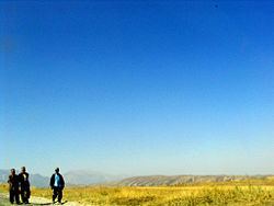
Until recently, travel by foreigners was not recommended because of security problems. To travel between Osh and Batken the road crosses the So'x enclave, which requires a double-entry Kyrgyz visa and an Uzbek transit visa: it is possible to take an unmetalled road around the enclave. The southern mountains offer excellent, but very difficult climbing with many sheer rock faces. Summits are Pyramid Peak [5,509 meters (18,074 ft)] and Pik Skalistiy [5,621 meters (18,442 ft)].