
Country United States State | Population 85,728 (2013) Area 429 sq mi Founded 1742 | |
 | ||
Rivers Bennett Creek, Knotts Creek | ||
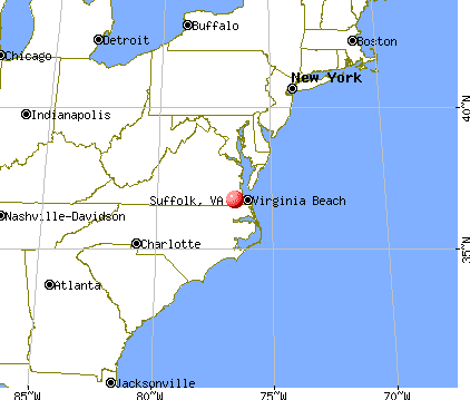
Map of Suffolk, Virginia
Suffolk is an independent city in the Commonwealth of Virginia. As of the 2014 census, the estimated population was 86,806 It is the largest city in Virginia by area as well as the 14th largest in the country.
Contents
- Map of Suffolk Virginia
- 1004 teton circle suffolk va 23435 3br2 5ba real property management hampton roads
- History
- Geography
- Demographics
- Adjacent counties and cities
- National protected areas
- 2008 tornado
- Education
- Transportation
- Bike trails
- Waterways
- Railroads
- Highways
- Bridges bridge tunnel
- Economy
- Media
- Boroughs
- Sister cities
- Notable people
- Climate
- References
Suffolk is located in the Hampton Roads metropolitan area which also includes the independent cities of Chesapeake, Hampton, Newport News, Norfolk, Portsmouth, and Virginia Beach, as well as other smaller cities, counties, and towns of Hampton Roads. With miles of waterfront property on the Nansemond and James River, present day Suffolk was formed in 1974 after consolidating with Nansemond County and the towns of Holland and Whaleyville. The current mayor is Linda T. Johnson.
1004 teton circle suffolk va 23435 3br2 5ba real property management hampton roads
History

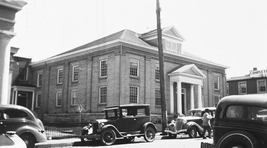
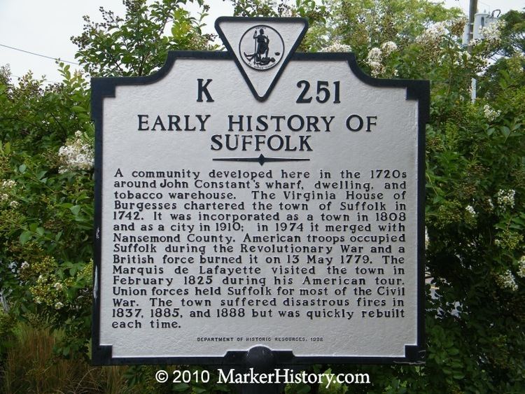
Suffolk was founded by English colonists in 1742 as a port town on the Nansemond River in the Virginia Colony. Originally known as Constant's Warehouse, for John Constant, Suffolk was renamed after Royal Governor William Gooch's home of Suffolk, a county in East Anglia, England. Before European contact, indigenous American tribes lived in the region for thousands of years. At the time of English settlement, the Nansemond Indians lived along the river. In the early colonial years, the English cultivated tobacco as a commodity crop, but later turned to mixed farming. It became the county seat of Nansemond County in 1750.
Early in its history, Suffolk became a land transportation gateway to the areas east of it in South Hampton Roads. Before the American Civil War, both the Portsmouth and Roanoke Railroad and the Norfolk and Petersburg Railroad were built through Suffolk, early predecessors of 21st century Class 1 railroads operated by CSX Transportation and Norfolk Southern, respectively. Other railroads and later major highways followed after the war.
Suffolk became an incorporated town in 1808. In 1910, it incorporated as a city and separated from Nansemond County. However, it remained the seat of Nansemond County until 1972, when its former county became the independent city of Nansemond. In 1974, the independent cities of Suffolk and Nansemond merged under Suffolk's name and charter.
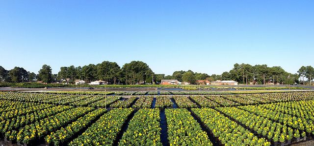
Peanuts grown in the surrounding areas became a major industry for Suffolk. Notably, Planters' Peanuts was established in Suffolk beginning in 1912. Suffolk was the 'birthplace' of Mr. Peanut, the mascot of Planters' Peanuts. For many years, the call-letters of local AM radio station WLPM stood for World's Largest Peanut Market.
Geography
Suffolk is located at 36°44′29″N 76°36′36″W (36.741347, -76.609881).
According to the United States Census Bureau, the city has a total area of 429 square miles (1,110 km2), of which 400 square miles (1,000 km2) is land and 29 square miles (75 km2) (6.7%) is water. It is the largest city in Virginia by land area and second-largest by total area. Part of the Great Dismal Swamp is located in Suffolk.
Demographics
As of the census of 2010, there were 84,585 people, 23,283 households, and 17,718 families residing in the city. The population density was 159.2 people per square mile (61.5/km2). There were 24,704 housing units at an average density of 61.8 per square mile (23.8/km2). The racial makeup of the city was 50.1% White, 42.7% Black or African American, 0.3% Native American, 1.6% Asian, 0.1% Pacific Islander, 0.8% from other races, and 2.3% from two or more races. Hispanics or Latinos of any race were 2.9% of the population.
There were 23,283 households out of which 36.6% had children under the age of 18 living with them, 55.1% were married couples living together, 16.8% had a female householder with no husband present, and 23.9% were non-families. 20.2% of all households were made up of individuals and 8.1% had someone living alone who was 65 years of age or older. The average household size was 2.69 and the average family size was 3.09.
The age distribution was 27.8% under the age of 18, 7.1% from 18 to 24, 31.1% from 25 to 44, 22.5% from 45 to 64, and 11.4% who were 65 years of age or older. The median age was 36 years. For every 100 females there were 91.4 males. For every 100 females age 18 and over, there were 87.4 males.
The median income for a household in the city was $41,115, and the median income for a family was $47,342. Males had a median income of $35,852 versus $23,777 for females. The per capita income for the city was $18,836. About 10.8% of families and 13.2% of the population were below the poverty line, including 18.2% of those under age 18 and 11.2% of those age 65 or over.
As of 2005, the city's median income jumped to $60,484 due to the influx of government-related high-tech jobs in the city's northern corridor and wealthy residents, causing it to be a close second to its neighbor Chesapeake in South Hampton Roads.
Adjacent counties and cities
National protected areas
2008 tornado
The city was hit by an EF3 tornado which produced a large swath of extensive damage through the city and nearby communities during the late afternoon of April 28, 2008.
After 4:00 PM EDT on April 28, a tornado touched down multiple times, causing damage and leaving over 200 injured in Suffolk along a path which passed north and west of the downtown area striking near Sentara Obici Hospital and in the unincorporated town of Driver. The storm seriously damaged over 120 homes and 12 businesses. The subdivisions of Burnett's Mill and Hillpoint Farms were damaged particularly heavily, as well as several of the older historic structures in Driver. However, near Driver, large radio and television broadcast towers located in an antenna farm serving most of Hampton Roads were spared serious damage.
Governor Timothy Kaine declared a state of emergency and directed state agencies to assist the recovery and cleanup efforts. Police officers and firefighters from across Hampton Roads were sent to Suffolk to help in the quarantine and cleanup of the damaged areas.
On May 1, the property damages were estimated at $20 million.
Video of the tornado.
Education
Suffolk Public Schools, the local public school system, operates 12 elementary schools, four middle schools, three high schools, and one alternative school. Nansemond-Suffolk Academy is a private college preparatory school located on Pruden Blvd.
Transportation
Suffolk's early growth was fueled by its location and transportation considerations. These continue to be major factors in the 21st century.
Bike trails
The Dismal Swamp National Wildlife Refuge includes dozens of miles of trails accessible via White Marsh Road at Washington Ditch and other entry sites. Additional bike trails can be found at Lone Star Lakes City Park off Godwin Blvd. This city park provides over 4 miles (6.4 km) of rock trails. There are many rural roads with light traffic available for road riding. Adjacent to Suffolk is Smithfield, where a city facility called Nike Park includes a bike trail approximately 2 1⁄2 miles in a loop.
Waterways
Suffolk was initially a port at the head of navigation of the Nansemond River. The Nansemond flows into the James River near its mouth and the ice-free harbor of Hampton Roads.
Railroads
The two railroads completed through Suffolk before the American Civil War were later joined by four more. These were eventually consolidated during the modern merger era of North American railroads which began around 1960. Today, Suffolk is served by three freight railroads, and is located on a potential line for high speed passenger rail service between Richmond and South Hampton Roads being studied by the Virginia Department of Rail and Public Transportation.
Highways
Suffolk is served by U.S. Highways 17, 13, 58, 258, and 460. Interstate 664, part of the Hampton Roads Beltway, crosses through the northeastern edge of the city. State Route 10 is also a major highway in the area.
In 2006, Suffolk assumed control of its road system from the Virginia Department of Transportation, which is customary among Virginia's independent cities, although since the Byrd Road Act of 1932 created Virginia's Secondary Roads System, which maintains the roads in most counties and town. An exception was made by the General Assembly when the former Nansemond County became an independent city and consolidated Suffolk in the 1970s. The state still maintained the primary and secondary routes in Suffolk until July 1, 2006.
Bridges, bridge-tunnel
The Monitor–Merrimac Memorial Bridge–Tunnel connects Suffolk to the independent city of Newport News on the Virginia Peninsula from South Hampton Roads and is part of the Hampton Roads Beltway, a circumferential interstate highway which links the seven largest cities of Hampton Roads. Completed in 1992 it provided a third major vehicle crossing of the Hampton Roads harbor area and cost $400 million to build.
There have been conflicts with VDOT and the city over ownership and responsibility for the circa 1928 Kings Highway Bridge across the Nansemond River on State Route 125, which was closed in 2005 by VDOT for safety reasons. About 3,300 motorists a day used the bridge that connected Chuckatuck and Driver. Now, they face detours of as much as 19 miles (31 km). The cost of a new bridge for the King's Highway crossing is estimated at $48 million, far more than could be recovered through collection of tolls at that location. In 2007, VDOT announced that it would contract for demolition and removal of the bridge. According to newspaper accounts, this will be the first time in VDOT's history of such action when no replacement facility was planned.
Virginia is currently reviewing proposals under a public-private partnership for a major realignment and upgrade of U.S. 460 from Suffolk west to Interstate 295 near Petersburg. In 1995, the Virginia General Assembly passed the Public-Private Transportation Act allowing private entities to propose innovative solutions for designing, constructing, financing, and operating transportation improvements. The new roadway would be funded through collection of tolls.
As part of the Suffolk 2026 Comprehensive Plan, the city plans to bypass the crossroads community of Whaleyville in southwestern Suffolk City. US 13 (along with NC Highway 11) is a strategic highway corridor in North Carolina towards Greenville.
Economy
In modern times, Suffolk remains a major peanut processing center and railroad and highway transportation hub. It hosts a diverse combination of industrial, manufacturing, distribution, retail, and hospitality businesses, as well as active farming.
In 2002, the new Louise Obici Memorial Hospital was completed and dedicated, acquired in 2005 by the Sentara Health System. Planters' Peanuts has been a major employer, now owned by Kraft Foods. Each fall since 1977, the City of Suffolk hosts Suffolk Festivals Incorporated's annual Peanut Fest. Other large employers in the City of Suffolk include Unilever, Lipton Tea, Wal-Mart, Target, QVC, and two major modeling and simulation companies, Lockheed Martin and Raytheon. Lockheed Martin built its "Center for Innovation" around a lighthouse in Suffolk, for which the campus is called 'The Lighthouse'. Raytheon won a DoD contract to manufacture 'Miniature Air-Launched Decoy Jammers'(MALD-J), which it has been producing with Cobham Composite Products:202 vehicles for a price of $81 million .
Suffolk experienced a boom in its high tech economy given the presence of the U.S. Joint Forces Command (JFCOM) facility near the intersection of US 17 and Interstate 664. In 1999, JFCOM stood up and through the decade JFCOM employed more and more defense contractors until it reached over 3,000. By September 2010, US Secretary of Defense Robert Gates recommended to decommission JFCOM as a matter of reallocating and rebalancing the U.S. Department of Defense budget to better address changing needs and fiscal demands. The announcement led to speculation about what impact the loss of JFCOM would have on the Hampton Roads economy in general and (more specifically) the sustainment of businesses located in the Harborview section of Suffolk. In August 2011 JFCOM was disestablished; many critical JFCOM functions like joint training, joint exercises and joint development were retained in the buildings vacated by JFCOM in north Suffolk under the auspices of the Joint Staff J7 Directorate, referred to as either "Pentagon South" or "Joint and Coalition Warfighting".
By summer 2013, city officials expected the Naval Network Warfare Command, NNWC Global Network Operations Center Detachment, Navy Cyber Defense Operations Command and Navy Cyber Forces to occupy buildings vacated by JFCOM. These commands have been considered a boon to north Suffolk bringing an estimated 1,000 additional employees, counting military, civilians and contractors with an estimated annual payroll of $88.9 million.
Media
Suffolk's daily newspapers are the local Suffolk News-Herald, the Virginian-Pilot from Norfolk and the Daily Press of Newport News. Other papers include the New Journal and Guide, and Inside Business. Coastal Virginia Magazine serves as a bi-monthly regional magazine for Suffolk and the Hampton Roads area. Hampton Roads Times serves as an online magazine for all the Hampton Roads cities and counties. Suffolk is served by a variety of radio stations on the AM and FM dials, with towers located around the Hampton Roads area.
Suffolk is also served by several television stations. The Hampton Roads designated market area (DMA) is the 42nd largest in the U.S. with 712,790 homes (0.64% of the total U.S.). The major network television affiliates are WTKR-TV 3 (CBS), WAVY 10 (NBC), WVEC-TV 13 (ABC), WGNT 27 (CW), WTVZ 33 (MyNetworkTV), WVBT 43 (FOX), and WPXV 49 (ION Television). The Public Broadcasting Service station is WHRO-TV 15. Suffolk residents also can receive independent stations, such as WSKY broadcasting on channel 4 from the Outer Banks of North Carolina and WGBS-LD broadcasting on channel 11 from Hampton. Suffolk is served by Charter Communications. The City of Suffolk Media & Community Relations Department operates Municipal Channel 8 on the local Charter Cable television system. Programming includes television coverage of many City activities and events, including live Government-access television (GATV) broadcasts of all regular City Council meetings, and special features including "On The Scene", "Suffolk Seniorcize", and "Suffolk Business Today". DirecTV and Dish Network are also popular as an alternative to cable television in Suffolk.
Boroughs
Suffolk is divided politically into seven boroughs, one corresponding to the former city of Suffolk and one corresponding to each of the six magisterial districts of the former Nansemond County. The boroughs are Chuckatuck, Cypress, Holy Neck, Nansemond, Sleepy Hole, Suffolk, and Whaleyville.
Sister cities
In 1981, Suffolk County, England became Suffolk's first sister city as a result of the personal interest in the Sister Cities concept by Virginia's Governor, Mills E. Godwin. A native of the city, Governor Godwin believed that Sister Cities would benefit the community culturally and educationally. Suffolk's second sister city relationship with Oderzo, Italy, began in 1995 because of one man, Amedeo Obici. Mr. Obici was a native of Oderzo and the founder of Planters Nut and Chocolate Company in Suffolk.
Suffolk Sister Cities International, Inc. (SSCI) is a 501 (c)(3) nonprofit established to promote international relationships as directed by Suffolk City Council through its appointed Suffolk Sister Cities Commission. Its membership is open to all who are interested in fostering the goals of the organization.
SSCI and its international youth association, SIYA, have won national awards for Youth and Education and for the Best Overall Program for cities with populations less than 100,000.
Notable people
Climate
The climate in this area is characterized by hot, humid summers and generally mild to cool winters. According to the Köppen Climate Classification system, Suffolk has a humid subtropical climate, abbreviated "Cfa" on climate maps.