
Admin. region Oberbayern Elevation 476-502 m (−1,171 ft) Area 26.51 km² Population 9,856 (31 Dec 2008) | Time zone CET/CEST (UTC+1/+2) Local time Monday 5:06 PM Postal code 83071 | |
 | ||
Weather 16°C, Wind NE at 19 km/h, 31% Humidity | ||
Stephanskirchen is a municipality in the district of Rosenheim, Upper Bavaria in Germany.
Contents
- Map of 83071 Stephanskirchen Germany
- Geography
- Subdivisions
- Emblem
- History
- Famous people
- Companies and infrastructure
- References
Map of 83071 Stephanskirchen, Germany
Geography
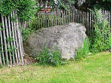
Stephanskirchen is located on a glacially formed plateau. The Inn river on the west and the lake Simssee are natural boundaries. The valley of the Sims river is a natural border at the south. North to Stephanskirchen are several forests and small lakes. The municipality is located within the Rosenheim-basin in the area of the former Inn-glacier. Therefore, numerous erratic boulders can be found here.
Subdivisions
The municipality is by population the third largest in the district of Rosenheim and consists of 48 parts (Ortsteile). Major settlements are Schloßberg and Haidholzen. Further settlements are: Baierbach, Eckenholz, Eichbichl, Eitzing, Entleiten, Fussen, Gehering, Graben, Grasweg, Haiden, Hofau, Hofleiten, Hofmühle, Högering, Höhensteig, Innleiten, Kieling, Kleinholzen, Kohlhaufmühle, Kragling, Kreut, Kronstauden, Krottenhausmühle, Kuglmoos, Lack, Landl, Landlmühle, Lauterbacherfilze, Leiten, Leonhardspfunzen, Murnau, Neumühle, Oed, Pulvermühle, Puster, Reikering, Schömering, Sims, Simserfilze, Simssee, Sonnenholz, Stephanskirchen, Waldering, Weinberg, Westerndorf, Westerndorferfilze and Ziegelberg.
Emblem
The emblem of Stephanskirchen was created in 1954 and indicates the historic dispartment: The holy Stephanus at the top symbolizes with his holy halo the area of Stephanskirchen. He holds a golden missal with tree golden stones in his left arm. The lower part of the emblem reminds of a dinghy, a so called "Mutze". This is because in the past the major source of income in Schloßberg, Hofleiten and close to the inn-shore was fishing and shipping. The dominant green color within the emblem points to the agricultural structure of Stephanskirchen.
History
The oldest traces were dated third and fourth century BC and can be found in the Doblergraben and at the Ziegelberg. An old Roman road crossed the River Inn at Leonhardspfunzen. The bridge was called "pons aeni" and headed westwards towards Augsburg. The first reports of a Christian church in the area around Sims are dated at 790 AD (ecclesia ad sinsa). Stephanskirchen was first mentioned in a record in the year 1130 where it was named "stevenchirgen". On the Schlossberg there was the Rosenheim castle which was first mentioned in the year 1234. It was used for administration and as a legal court of the Wittelsbacher; at the beginning of the 19th century it deteriorated.
Plague epidemic of the Middle Ages took their toll in Stephanskirchen, too. In the forest between Kieling and Baierbach a memorial stone can be found which got placed in memory of those who got buried there. The inscription reads:
Während des Dreißigjährigen Krieges im Jahr 1632 herrschte in den Ortschaften der Umgebung die Pest. Viele Menschen starben an dieser Krankheit und wurden hier an diesem stillen Ort in Massengräbern bestattet. Der Überlieferung nach sind ganze Ortschaften ausgestorben. In Kieling blieb nur ein kleines Mädchen übrig. Dieses steinerne Kreuz wurde zum Gedenken an die Toten aufgestellt. (Geschichtlich überliefert durch Pfarrer Angerer, Stephanskirchen).
Translated it says:
In the year 1632 during the Thirty Years' War a plague epidemic ruled the localities and the surrounding areas. Many humans died due to that disease and got buried at this silent place in mass graves. According to historical tradition some villages totally died out. In Kieling only a little girl survived. This stony cross got erected in memory of these deaths (Historically passed down by priest Angerer, Stephanskirchen).
Rural structures were predominant in the ancestor areas of the municipality Stephanskirchen up to the 18th century. Stephanskirchen and the newly developed workers and day labourer housing estate Hofleiten became autonoumous political communities through the Bavarian administrative reform of the year 1818. In 1854 Hofleiten and Stephanskirchen got unified. Due to the social differences fierce conflicts between parts of the community persisted until the late 19th century. Since 1900 Schloßberg became the largest part of the municipality due to its vicinity to Rosenheim.
Between December 4, 1944 and March 31, 1945 in the district Haidholzen there was a subcamp of the Dachau concentration camp housing around 200 prisoners. Polish, Russian and French prisoners of war were captured in a barrack settlement within the area of a flak casern. The main building of this flak casern exists until today; since 1947 there are manufacturing facilies of a candy factory. The prisoners worked for regional contractors and for the "Chiemgauer Vertriebsgesellschaft O.H.G.", which was a subsidiary of the company BMW. They produced plane engines there but never fully went into production. Several independent sources report about homicides of the imprisoned people. By the end of 1944 the production plant became a target of air attacks during which two employees were killed. 30% of the buildings and 20% of the machinery were destroyed, the created damage was rated ℛℳ 250,000. By command of Heinrich Himmler an evacuation into rearward concentration camps started in March and April 1945 during which many prisoners died due to exhaustion or being shot by the SS.
After the end of World War II around 1500 refugees and expellees came to Stephanskirchen and founded the settlement Haidholzen close to the former flak casern. Streets named "Schlesierstraße" or "Sudetenlandstraße" remind up to today of the origin of these people.
Famous people
Companies and infrastructure
Two internationally known companies can be found in Stephanskirchen: Marc O’Polo, which has its international headquarters there, and ARRI.
In 1978 an elementary school was opened in Stephanskirchen; like 7 other schools in Germany it is named in honor of the author Otfried-Preußler, who lives in Haidholzen. The Otfried-Preußler-Schule is the only currently participating UNESCO project school of all schools in Bavaria. Around 550 pupils are spread amongst 25 classes. The elementary school has 8 classes and the "Hauptschule" has 17 classes; of those, 6 lead to a secondary school level certificate. An after-school supervision is offered by the "Arche"-association.
In Schloßberg there is the "Volksschule Schloßberg", an elementary school hosting about 200 pupils.
There are four Kindergarten in Stephanskirchen. The Catholic Kindergarten "St. Georg" in Schloßberg, the Catholic Kindergarten "Sonnenschein" in Haidholzen, the Catholic Church Kindergarten "Bärenstube" in Stephanskirchen and the Protestant Kindergarten "Regenbogen" in Schloßberg.
In 2003 a new town hall was opened in Schloßberg.