Population 851 (in 2011) Unitary authority Dialling code 01666 | OS grid reference ST907799 Sovereign state United Kingdom | |
 | ||
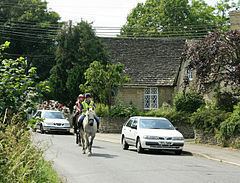
Stanton St Quintin is a small village and civil parish in the county of Wiltshire in England. It is about 4 miles (6.4 km) north of Chippenham and 5 miles (8.0 km) south of Malmesbury. The parish includes the hamlets of Lower Stanton St Quintin, 0.6 miles (0.97 km) to the northeast on the A429 road, and Clanville.
Contents
Map of Stanton St. Quintin, UK
History
A Roman villa site was found at Stanton Park in the west of the parish, about 3 miles (4.8 km) east of the Fosse Way.
The St Quintin suffix is from the surname of a 13th-century lord of the manor.
In 1971 the M4 motorway was built near to the southern boundary of the parish.
Local government
The civil parish elects a parish council. It is in the area of Wiltshire Council unitary authority, which is responsible for all significant local government functions.
Amenities
There is a village hall and a primary school.
The Anglican Church of St Giles is Grade II* listed. It dates from the 12th century; in 1888 the chancel was rebuilt by C.E. Ponting and nave windows by Christopher Whall were installed.
Stanton St. Quintin Quarry and Motorway Cutting is a geological Site of Special Scientific Interest.
Military connections
The southern part of Hullavington Airfield (formerly RAF Hullavington) is in the parish, along with the associated barracks which were renamed Buckley Barracks in 2003.
