
Existed: 1961 – present Constructed 1961 | History: Constructed 1961–96 To: Pont Abraham services Length 304.2 km | |
 | ||
Primarydestinations: LondonHeathrow SloughMaidenheadBracknellReadingNewburySwindonChippenhamBristolNewportCardiffBridgendPort TalbotNeathSwanseaLlanelli | ||
Dangerous driver on the m4 motorway
The M4 is a motorway which runs between London and South Wales in the United Kingdom. Major towns and cities along the route include Slough, Reading, Swindon, Bristol, Newport, Cardiff and Swansea. Originally referred to as the London-South Wales Motorway, the English section, including a suspension bridge over the River Severn, was constructed between 1965 and 1971; the Welsh element was completed in 1993. A new Severn bridge, known as the Second Severn Crossing, was opened in 1996 with the M4 rerouted to use it.
Contents
- Dangerous driver on the m4 motorway
- Map of M4 Port Talbot SA13 UK
- 20161007 m4 motorway crash
- History
- Toll bridge
- Speed limits
- M4 bus lane
- Porous road surface
- Elevated and heated section
- Four level stack interchanges
- Smart managed motorway
- Tunnels
- Notable junctions
- Maintenance
- Hard shoulder running from Junction 3 to Junction 12
- New junctions 15a 18a
- M4 Junction 31
- M4 relief road around Newport
- Port Talbot Junctions 40 and 41
- Incidents and accidents
- Junctions
- References
Map of M4, Port Talbot SA13, UK
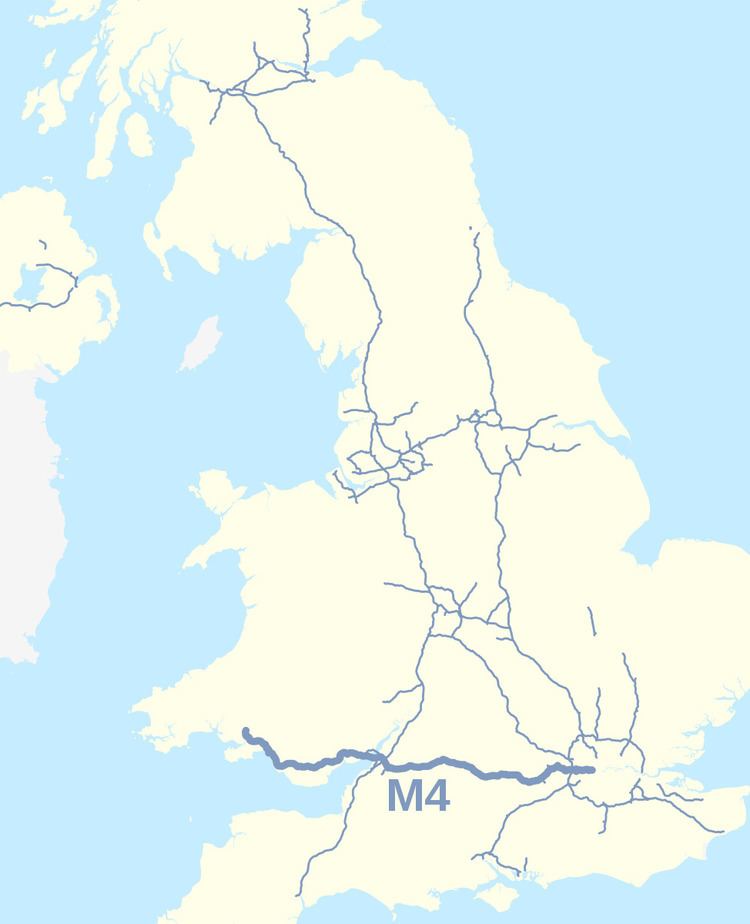
The M4 runs close to the A4 from London to Bristol. After crossing the River Severn it follows the A48 through South Wales, using the Brynglas Tunnels at Junction 25a, Newport and terminates just north of Pontarddulais. It is one of only three motorways in Wales; the other two, the A48(M) and M48, branch off it. The area of land along the M4, with its towns and cities, is known as the M4 corridor. European route E30 includes most of the M4, although it is not signed as such.
20161007 m4 motorway crash
History
A new road from London to South Wales was first proposed in the 1930s, and the Ministry of Transport announced plans for the M4 as one of the first major post-war trunk road improvement projects in 1956.
The Chiswick flyover, a short section of elevated dual-carriageway built to reduce the impact of traffic travelling between central London and the west, opened in 1959; it was not originally classed as a motorway. The Maidenhead bypass opened in 1961 whilst J1-J5 opened in 1965. The stretch from J18 to the west of Newport was opened in 1966, including the Severn Bridge (now part of the M48). The Port Talbot by-pass, also built in the 1960s and now part of the M4, was originally the A48(M) motorway, a number now allocated to a short section of motorway near Cardiff. The Ministry of Transport originally intended that the M4 would terminate at Tredegar Park west of Newport, and it was only following the creation of the Welsh Office that the Government became committed to a high-standard dual carriageway to Pont Abraham in Carmarthenshire.
The English section of the motorway was completed on 22 December 1971 when the 50-mile (80 km) stretch between Junctions 9 and 15 (Maidenhead and Swindon) was opened to traffic. The Welsh section was completed in 1993, when the Briton Ferry motorway bridge opened. The Second Severn Crossing opened in 1996, together with new link motorways on either side of the estuary to divert the M4 over the new crossing. The existing route over the Severn Bridge was redesignated the M48, and the new M49 was opened to connect the new crossing to the M5.
In June 1999 the section of the third lane (the lane nearest the central reservation) between Junctions 2 and 3 was converted to a bus lane, first as a pilot scheme and then permanently in 2001. A lower speed limit was introduced along the bus lane section at the same time (the lane was however reverted to general traffic use by the incoming coalition government in late 2010).
In April 2005 speed checks carried out by police camera vans between Junction 14 and Junction 18 led to a public protest, involving a "go-slow" of several hundred vehicles along the affected sections of the motorway.
Between 2007 and January 2010 the section from Castleton (Junction 29) to Coryton (Junction 32) was widened to six lanes. The scheme was formally opened on 25 January 2010 by Ieuan Wyn Jones the Deputy First Minister for Wales.
During 2009 the Newport section of the motorway between Junctions 23a and 29 was upgraded with a new concrete central barrier. In February 2010 it was proposed that the M4 in South Wales would become the first hydrogen highway with hydrogen stations provided along the route, with an aspiration for further stations to be provided along the M4 into South West England over time. A similar claim was made for a 30-mile (48 km) section of road in Scotland close to Aberdeen in September 2009 with refuelling points at Bridge of Don, Ellon and Peterhead.
In October 2010 the new Secretary of State for Transport, Philip Hammond, announced that the bus lane in the London section would be suspended for 18 months from 24 December 2010, be brought back into use temporarily for the 2012 Summer Olympics, and then be removed.
Between 2008 and 2010, Junction 11, near Reading, was extensively remodelled with a new four-lane motorway junction, two new road bridges and other works. The £65m scheme included work on the Mereoak roundabout and part of the A33 Swallowfield Bypass near Shinfield, and also the conversion of the two existing bridges, one of which is available only to pedestrians and cyclists and the other to buses. It also involved the movement of the local Highways Agency and Fire Service offices, and the construction of a long footbridge network, a new bus-lane and a new gyratory. Sound barriers for nearby residential areas were also installed. In April 2008, the decision to preserve a rare Vickers machine gun pillbox and turn it into a bat roost was announced by the developers.
The table below shows the timeline for the construction of the motorway on a section by section basis.
Toll bridge
The M4 crosses the River Severn via a toll bridge, the last of only three on the UK motorway network – the first was the original Severn Bridge, now part of the M48 and the second is the Queen Elizabeth II Bridge, part of the Dartford Crossing. Tolls are charged in one direction only: westbound. Drivers therefore have to pay to enter Wales, but not to enter England.
Speed limits
For the majority of its length, the national speed limit applies. Exceptions include the following:
M4 bus lane
Between 1999 and 2010 there was a controversial 3.5-mile (5.6 km) bus lane on the eastbound (London-bound) carriageway from Junction 3 (A312) to the western end of the Chiswick Flyover near Brentford, covering part of the 15-mile (24 km) journey between Heathrow Airport and central London. The lane which had no intermediate exits was for use by buses, coaches, motorcycles, emergency vehicles and licensed taxis but not mini-cabs. It was used by 7% of vehicles which carried 21% of the people.
The lane was restored for normal motorway running at the end of 2010 for 18 months using an Experimental Traffic Order and was re-established for the duration of the 2012 Summer Olympics with the intention that it would then be removed permanently.
Porous road surface
Near Junction 35 of the M4, there is a stretch of the motorway that has a surfacing of porous asphalt that improves drainage and reduces noise. When driving in heavy rain drivers notice a reduction in road spray from other vehicles and improved visibility. This special surface was publicised in an episode of the BBC's Tomorrow's World programme. This was the site of the first trial of the new road surface when it was laid down in 1993.
Elevated and heated section
The elevated section of the M4 in West London, built in the 1960s, is mostly directly above the A4 and extends over parts of Brentford's Golden Mile. This section was designed to have a heated road surface to reduce icing in winter.
Four level stack interchanges
The M4 has two of only three four-level stack interchanges in the UK, including the first UK example at the junction with the M5 (Junction 20/"Almondsbury Interchange") and the other at the junction with the M25 (J4b). Junction 4b also has to make provision for a railway line passing beneath the M4. Due to the nature of such junctions, it is impossible to make a u-turn at Junction 20 or Junction 4b.
Smart (managed) motorway
The M4 motorway has two sections of smart motorway between Junctions 19 (M32) and 20 (M5) north of Bristol, and between Junction 24 and Junction 29 north of Newport. The section between Junctions 19 and 20 have variable speed limits and a part-time hard-shoulder and was completed in early summer 2014. The section between Junctions 24 and 29 only has variable speed limits. It was designed save money through fewer accidents in the long term. Widening this section of the motorway is not possible because of the two-lane Brynglas Tunnels and existing housing close to the motorway.
Tunnels
The M4 passes through the Brynglas Tunnels at Junction 25a, Newport. These are the only twin–bored tunnels on the United Kingdom motorway network.
Notable junctions
Junction 8/9 at Maidenhead, Berkshire, is the only one in the UK with dual numbers. This a relic from when the M4 used to turn north after junction 8, where it met the A308, and head for the original Junction 9, where it ended on a roundabout interchange with the A4. When the westward extension was opened junction 8 was closed and a new junction built a little to the west, taking both numbers. The road to the A4 became A423(M) and later A404(M) and the junction with the A4 became 9B. Junction 9A is the exit for Cox Green and White Waltham. West of Junction 13 on the eastbound carriageway there are a set of sliproads signposted "Works Unit Only". The signs have red borders, implying a military exit. It is a back entrance to RAF Welford, a Second World War airfield and now an RAF/USAF military installation mainly used for storing munitions. The M4 entrance allows easier access for the large vehicles used to carry the munitions.
The section of the M4 in South Wales has to thread its way through mountainous terrain and built-up areas, so there are some unusual junction layouts. Junction 27 (High Cross) is a normal grade-separated roundabout junction, but subject to severe space constraints: traffic joining the motorway must initially travel in the opposite direction to the intended direction of travel, before making a sharp left-hand turn from the slip road onto the motorway. Junctions 30–31 (East Cardiff) were set aside for intermediate additional interchanges at the time of construction. Junction 30 (Cardiff Gate) has since been added but there are no current plans to construct Junction 31 (A469 road). Junction 39 can only be used to access the motorway from a single slip road onto the westbound carriageway from the A48 at Junction 38. There is no exit from the motorway at this junction.
Junction 41 comprises two different junctions, one for traffic to and from local destinations to the west and one for places to the east. The former leads to and from a spur leading to the roundabout in Briton Ferry, formerly known as Junction 41a, and the original bridge over the River Neath, which would allow access onto the stretch of the M4 from Junction 43 westward. The second, eastern junction leads to and from the A48 towards Port Talbot. As a result, it is possible in both directions to travel almost 2 miles (3.2 km) on the motorway, both joining and then leaving the motorway at "Junction 41". Junction 44 is unusual in that the eastbound entrance dives under the inside of the junction, effectively a creating a "right-turn" on a roundabout. Similarly, slip roads pass under or over the main motorway at Junctions 41 and 42.
Maintenance
Maintenance of the section of the motorway within England, some 123 miles (198 km), is the responsibility of the Highways Agency. The section within Wales, some 76 miles (122 km), is the responsibility of the Welsh Government.
Hard shoulder running, from Junction 3 to Junction 12
In 2010 it was announced that hard shoulder running would be introduced from Junction 3 to Junction 12. As of January 2012 no further information is available on the Highways Agency Website other than mention of the scheme on the main map showing the network and proposed works where it is proposed that work will start 'post 2015'.
New junctions: 15a, 18a
A new Junction 15a, being considered by Wiltshire Council, this would give access to South and Central Swindon as well as to Wroughton, Marlborough and Devizes via the existing A4361, as well as a possible Junction 18a which would connect with the A432 and A4174 giving better access to Bristol, via Mangotsfield, and also a direct link with Yate.
M4 Junction 31
Plans for the "missing" Junction 31, also known as the Thornhill interchange, for which planning permission was originally granted in September 1991 (but subsequently expired), were rekindled after proposals for a new business park on a 125 acres (51 ha) site north of the M4 were submitted in 2007 to Cardiff Council. The developers of the business park, St Modwen Developments, would likely fund the new junction, which would be on the A469.
A freedom of information request in 2010 to Cardiff Council shows that whilst the land that would enable this junction should continue to be strategically protected, the decision to formally abandon the proposed Junction 31 Thornhill was made in October 2007 and there had been no subsequent mention of it in Cardiff Council Strategic or Planning meetings since.
M4 relief road around Newport
Plans for an 'M4 Relief Road' around Newport were first announced by the Welsh Office in 1991, but made little progress. The Welsh Assembly Government revived the scheme as the M4 relief road tolled bypass in 2007 but later abandoned it for financial reasons. An extension to the Newport Southern Distributor Road through the old Corus steel works is being considered. This road is already a dual carriageway but not open to the public. A public consultation exercise on options for improving the capacity of the M4 corridor around Newport opened on 5 March 2012. Its website states that: "the motorway around Newport does not conform to today’s motorway standards. It lacks continuous hard shoulders, has closely spaced junctions with sub-standard slip road visibility and narrows to a restricted two lane section through the Brynglas Tunnels. Heavy congestion occurs along this stretch and either side of it at peak hours."
Port Talbot, Junctions 40 and 41
There have been calls to close the slip roads at Junction 40 and 41 (at Port Talbot) to improve traffic flow. The motorway has only two lanes on this stretch and is a major traffic congestion blackspot. Junctions 40 and 41 (at Port Talbot) have very short slip roads which have not been modernised. The Port Talbot peripheral distributor road is under development, which should divert local traffic away from the M4.