
Airport type Public Elevation AMSL 920 ft / 280 m 9/27 1,970 Phone +1 507-645-4030 | Website StantonAirfield.com Area 62 ha | |
 | ||
Owner Stanton Sport Aviation, Inc. Address 1235 Hwy 19 Blvd, Dennison, MN 55018, USA Similar Airlake Airport, Northfield Lines Inc, Northfield Celebrity Limousine, Carleton College, Minneap Paul Internatio | ||
Minnesota soaring stanton airfield schweizer 1 35c take off and landing
Stanton Airfield (IATA: SYN, ICAO: KSYN, FAA LID: SYN) is a public use airport located one nautical mile (1.85 km) east of the central business district of Stanton, in Goodhue County, Minnesota, United States. The airport is privately owned by Stanton Sport Aviation, Inc.
Contents
- Minnesota soaring stanton airfield schweizer 1 35c take off and landing
- Historic stanton airfield ww ii flight training cpt program
- History
- Facilities and aircraft
- References
Historic stanton airfield ww ii flight training cpt program
History
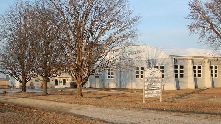
Carleton Airport has been in operation since 1942, when Carleton College bought a farm to use as an airport to train pilots for World War II. In 1944, the college leased the field to Triangle Aviation, operated by Malcolm and Margaret Manuel, which eventually bought the airport in 1955. In 1990, Stanton Sport Aviation was formed to purchase the airport. The airport was added to the National Register of Historic Places in 2004.
Facilities and aircraft
Stanton Airfield covers an area of 158 acres (64 ha) at an elevation of 920 feet (280 m) above mean sea level. It has two runways with turf surfaces: 9/27 is 1,970 by 180 feet (600 x 55 m) and 18/36 is 2,550 by 200 feet (777 x 61 m).
For the 12-month period ending August 31, 2007, the airport had 15,000 general aviation aircraft operations, an average of 41 per day. At that time there were 47 aircraft based at this airport: 36% single-engine and 64% glider.