
From: Corstopitum Length 61.2 km | ||
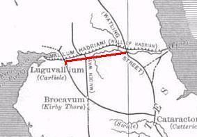 | ||
The Stanegate, or "stone road" (Old Norse), was an important Roman road built in what is now northern England. It linked two forts that guarded important river crossings; Corstopitum (Corbridge) in the east, situated on Dere Street, and Luguvalium (Carlisle) in the west. The Stanegate ran through the natural gap formed by the valleys of the Tyne and Irthing. It predated Hadrian's Wall by several decades; the Wall would later follow a similar route, slightly to the north.
Contents
- Map of Stanegate Hexham UK
- History
- Structure
- Route
- List of forts on the Stanegate
- Subsequent history
- References
Map of Stanegate, Hexham, UK
The Stanegate differed from most other Roman roads in that it often followed the easiest gradients, and so tended to weave around, whereas typical Roman roads follow a straight path, even if this sometimes involves having punishing gradients to climb.
History
It is believed that the Stanegate was probably built under the governorship of Agricola. It is also thought that it was built as a strategic road when the northern frontier was on the line of the Forth and Clyde, and only later became part of the frontier when the Romans withdrew from what is now Scotland. An indication of this is that it was provided with forts at one-day marching intervals (14 Roman miles or modern 13 miles (21 km)), sufficient for a strategic non-frontier road. The forts at Vindolanda (Chesterholm) and Nether Denton have been shown to date from about the same time as Corstopitum and Luguvalium, in the 70s AD and 80s AD. When the Romans decided to withdraw from Scotland, the line of the Stanegate became the new frontier and it became necessary to provide forts at half-day marching intervals. These additional forts were Newbrough, Magnis and Brampton Old Church. It has been suggested that a series of smaller forts were built in between the 'half-day-march' forts. Haltwhistle Burn and Throp might be such forts, but there is insufficient evidence to confirm a series of such fortlets. The retreat from Scotland took place in about 105 AD, and so the strengthening of the Stanegate defences would date from about that time.
Structure
Where it left the base of Corstopitum, the Stanegate was 22 feet (6.7 m) wide with covered stone gutters and a foundation of 6-inch (150 mm) cobbles with 10 inches (250 mm) of gravel on top.
Route
The Stanegate began in the east at Corstopitum, where the important road, Dere Street headed towards Scotland. West of Corstopitum, the Stanegate crossed the Cor Burn, and then followed the north bank of the Tyne until it reached the North Tyne near the village of Wall. A Roman bridge must have taken the road across the North Tyne, from where it headed west past the present village of Fourstones to Newbrough, where the first fort is situated, 7 1⁄2 miles (12.1 km) from Corbridge, and 6 miles (9.7 km) from Vindolanda. It is a small fort occupying less than an acre and is in the graveyard of Newbrough church.
From Newbrough, the Stanegate proceeds west, parallel to the South Tyne until it meets the next major fort, at Vindolanda (Chesterholm). From Vindolanda the Stanegate crosses the route of the present-day Military Road and passes just south of the minor fort of Haltwhistle Burn. From Haltwhistle Burn, the Stanegate continues west away from the course of the South Tyne and passes the major fort of Magnis, 6 1⁄2 miles (10.5 km) from Vindolanda and 20 miles (32 km) from Corstopitum. At this point, the road is joined by the Maiden Way coming from Epiacum (Whitley Castle) to the south.
From Magnis, the road turns towards the southeast to follow the course of the River Irthing, passing the minor fort of Throp, and arriving at the major fort of Nether Denton, 4 1⁄2 miles (7.2 km) from Magnis and 24 1⁄2 miles (39.4 km) from Corstopitum. The fort occupies an area of about 3 acres (12,000 m2).
From Nether Denton, the road continues to follow the River Irthing and heads towards present-day Brampton. It passes the minor fort of Castle Hill Boothby and then, 1 mile (1.6 km) east of Brampton, reaches the next major fort, that of Brampton Old Church, 6 miles (9.7 km) from Nether Denton and 30 1⁄2 miles (49.1 km) from Corstopitum. The fort is so called because half of it is buried under Old St. Martin's church and its graveyard.
From Brampton Old Church, the road crosses the River Irthing and continues east through Irthington and High Crosby. It crosses the River Eden at some point and eventually reaches the fort of Luguvalium (Carlisle), 7 1⁄2 miles (12.1 km) from Brampton Old Church and 38 miles (61 km) from Corstopitum. It has been suggested that the road may have carried on west for a further 4 1⁄2 miles (7.2 km) to the Roman fort at Kirkbride overlooking Moricambe Bay, an inlet of the Solway Firth. A large camp of 5 acres (20,000 m2) was found there but the evidence is insufficient.
It has also been suggested that the Stanegate may have run eastwards from Corstopitum towards Pons Aelius, present-day Newcastle upon Tyne, but there is no evidence to support this.
List of forts on the Stanegate
Subsequent history
Much of the Stanegate provided the foundation for the Carelgate (or Carlisle Road), a medieval road running from Corbridge market place and joining the Stanegate west of Corstopitum. The Carelgate eventually deteriorated to such an extent that it was unusable by coaches and wagons. In 1751–1752, a new Military Road was built by General George Wade in the wake of the Jacobite rising of 1746.