
Area 1,694 km² Population 86,308 (2013) | Congressional district 3rd Website www.stclairco.com Founded 20 November 1818 | |
 | ||
Rivers Coosa River, Cahaba River, Little Canoe Creek Destinations | ||
Help st clair county alabama traffic speeding ticket lawyer best st clair county traffic attorney
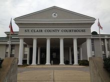
St. Clair County is a county of the U.S. state of Alabama. As of the 2010 census, the population was 83,593. It has two county seats in Ashville and another in Pell City. It is one of two counties in Alabama, and one of 33 in the United States, with more than one county seat. Its name is in honor of General Arthur St. Clair, an officer in the French and Indian War.
Contents
- Help st clair county alabama traffic speeding ticket lawyer best st clair county traffic attorney
- Map of St Clair County AL USA
- History
- Geography
- Adjacent counties
- Rail
- Demographics
- 2010 census
- Cities
- Places of interest
- References
Map of St Clair County, AL, USA
St. Clair County is included in the Birmingham-Hoover, AL Metropolitan Statistical Area.
History
St. Clair County was established on November 20, 1818 by the Alabama Territory legislature by splitting the area from Shelby County. The county seat was incorporated and named "Ashville" in honor of John Ash. In 1836, a portion of St. Clair County was separated to establish Cherokee County and DeKalb County. In 1866, after the Civil War, a northeast section of the county was used to create Etowah County.
Geography
According to the U.S. Census Bureau, the county has a total area of 654 square miles (1,690 km2), of which 632 square miles (1,640 km2) is land and 22 square miles (57 km2) (3.3%) is water.
Adjacent counties
Rail
Demographics
As of the census of 2000, there were 64,742 people, 24,143 households, and 18,445 families residing in the county. The population density was 102 people per square mile (39/km2). There were 27,303 housing units at an average density of 43 per square mile (17/km2). The racial makeup of the county was 90.03% White, 8.13% Black or African American, 0.37% Native American, 0.17% Asian, 0.03% Pacific Islander, 0.41% from other races, and 0.85% from two or more races. 1.06% of the population were Hispanic or Latino of any race.
In 2000 the largest ancestry groups in St. Clair county were:
There were 24,143 households out of which 35.10% had children under the age of 18 living with them, 62.80% were married couples living together, 10.00% had a female householder with no husband present, and 23.60% were non-families. 20.80% of all households were made up of individuals and 8.20% had someone living alone who was 65 years of age or older. The average household size was 2.60 and the average family size was 3.01.
In the county, the population was spread out with 25.40% under the age of 18, 7.90% from 18 to 24, 30.70% from 25 to 44, 24.30% from 45 to 64, and 11.70% who were 65 years of age or older. The median age was 36 years. For every 100 females there were 101.80 males. For every 100 females age 18 and over, there were 98.80 males.
The median income for a household in the county was $37,285, and the median income for a family was $43,152. Males had a median income of $33,914 versus $24,433 for females. The per capita income for the county was $17,960. About 9.60% of families and 12.10% of the population were below the poverty line, including 15.20% of those under age 18 and 12.60% of those age 65 or over.
2010 census
As of the census of 2010, there were 83,593 people, 31,624 households, and 23,364 families residing in the county. The population density was 132 people per square mile (51/km2). There were 35,541 housing units at an average density of 56 per square mile (22/km2). The racial makeup of the county was 88.2% White, 8.6% Black or African American, 0.3% Native American, 0.6% Asian, 0.1% Pacific Islander, 0.9% from other races, and 1.3% from two or more races. 2.1% of the population were Hispanic or Latino of any race.
There were 31,624 households out of which 30.7% had children under the age of 18 living with them, 58.3% were married couples living together, 11.2% had a female householder with no husband present, and 26.1% were non-families. 22.5% of all households were made up of individuals and 8.5% had someone living alone who was 65 years of age or older. The average household size was 2.58 and the average family size was 3.02.
In the county, the population was spread out with 23.7% under the age of 18, 7.8% from 18 to 24, 27.8% from 25 to 44, 27.6% from 45 to 64, and 13.1% who were 65 years of age or older. The median age was 38.6 years. For every 100 females there were 100.5 males. For every 100 females age 18 and over, there were 102.3 males.
The median income for a household in the county was $48,837, and the median income for a family was $56,107. Males had a median income of $43,287 versus $32,843 for females. The per capita income for the county was $22,192. About 8.3% of families and 10.6% of the population were below the poverty line, including 13.2% of those under age 18 and 9.5% of those age 65 or over.
Cities
Places of interest
St. Clair County is home to Logan Martin Lake. It also contains Horse Pens 40, a private outdoor park on top of Chandler Mountain.