
Population 81,096 (2013) | Congressional district 3rd Founded 18 December 1832 County seat Talladega | |
 | ||
Website www.talladegacountyal.org Points of interest Kymulga Mill & Covered, International Motorsports Hall of Fa, Kymulga Grist Mill Park, Comer Museum & Arts Center, Jemison Carnegie Heritage | ||
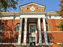
Talladega county alabama traffic ticket attorney speeding ticket lawyer talladega county al
Talladega County is a county of the U.S. state of Alabama. As of the 2010 census, the population was 82,291. Its county seat is Talladega.
Contents
- Talladega county alabama traffic ticket attorney speeding ticket lawyer talladega county al
- Map of Talladega County AL USA
- Help talladega county alabama traffic speeding ticket lawyer best talladega county traffic attorney
- History
- Geography
- Adjacent counties
- National protected area
- Demographics
- 2010 census
- Education
- Rail
- Cities
- Towns
- Census designated places
- Ghost town
- References
Map of Talladega County, AL, USA
Talladega County is included in the Talladega-Sylacauga, AL Micropolitan Statistical Area, which is also included in the Birmingham-Hoover-Talladega, AL Combined Statistical Area.
Help talladega county alabama traffic speeding ticket lawyer best talladega county traffic attorney
History
Prior to Euro-American settlement in what is today Talladega County it was the home of the Abihka tribe of the Creek Confederacy.
Talladega County was established on December 18, 1832, from land ceded by the Creek Indians near the state's geographic center. The county seat was established at Talladega in 1834.
The name Talladega is derived from a Muscogee (Creek) Native American word Tvlvteke, from the Creek tålwa, meaning "town", and åtigi, or "border" -- "Border Town"—a town indicating its location on the boundary between the lands of the Creek tribe and those of the Cherokee and Chickasaw.
Geography
According to the U.S. Census Bureau, the county has a total area of 760 square miles (2,000 km2), of which 737 square miles (1,910 km2) is land and 24 square miles (62 km2) (3.1%) is water. It is drained by Choccolocco Creek (archaic spelling: Chockolocko) and other streams.
Adjacent counties
National protected area
Demographics
As of the census of 2000, there were 80,321 people, 30,674 households, and 21,901 families residing in the county. The population density was 109 people per square mile (42/km2). There were 34,469 housing units at an average density of 47 per square mile (18/km2). The racial makeup of the county was 67.02% White, 31.55% Black or African American, 0.23% Native American, 0.20% Asian, 0.02% Pacific Islander, 0.27% from other races, and 0.71% from two or more races. Nearly 1.01% of the population were Hispanic or Latino of any race.
In 2000, the largest ancestry groups in Talladega County were:
There were 30,674 households, out of which 32.10% had children under the age of 18 living with them; 52.40% were married couples living together, 15.20% had a female householder with no husband present, and 28.60% were non-families. 25.90% of all households were made up of individuals, and 10.60% had someone living alone who was 65 years of age or older. The average household size was 2.50, and the average family size was 3.00.
In the county, the population was spread out with 25.00% under the age of 18, 9.00% from 18 to 24, 28.80% from 25 to 44, 23.90% from 45 to 64, and 13.30% who were 65 years of age or older. The median age was 37 years. For every 100 females, there were 95.70 males. For every 100 females age 18 and over, there were 93.50 males.
The median income for a household in the county was $31,628, and the median income for a family was $38,004. Males had a median income of $30,526 versus $21,040 for females. The per capita income for the county was $15,704. About 13.90% of families and 17.60% of the population were below the poverty line, including 24.70% of those under age 18 and 18.20% of those age 65 or over.
2010 census
As of the census of 2010, there were 82,291 people, 31,890 households, and 22,191 families residing in the county. The population density was 112 people per square mile (43/km2). There were 37,088 housing units at an average density of 50 per square mile (19/km2). The racial makeup of the county was 65.3% White, 31.7% Black or African American, 0.3% Native American, 0.4% Asian, 0.0% Pacific Islander, 1.0% from other races, and 1.3% from two or more races. Nearly 2.0% of the population were Hispanic or Latino of any race.
There were 31,890 households, out of which 27.8% had children under the age of 18 living with them; 47.2% were married couples living together, 17.5% had a female householder with no husband present, and 30.4% were non-families. 26.7% of all households were made up of individuals, and 10.1% had someone living alone who was 65 years of age or older. The average household size was 2.48, and the average family size was 2.98.
In the county, the population was spread out with 23.4% under the age of 18, 8.6% from 18 to 24, 25.8% from 25 to 44, 28.1% from 45 to 64, and 14.1% who were 65 years of age or older. The median age was 39.3 years. For every 100 females, there were 94.9 males. For every 100 females age 18 and over, there were 98.1 males.
The median income for a household in the county was $36,948, and the median income for a family was $44,695. Males had a median income of $38,430 versus $27,404 for females. The per capita income for the county was $18,713. About 15.3% of families and 18.4% of the population were below the poverty line, including 27.1% of those under age 18 and 15.7% of those age 65 or over.
Education
The Birmingham Supplementary School Inc. (BSS, バーミングハム日本語補習校 Bāminguhamu Nihongo Hoshūkō), a part-time Japanese school, has its office is at the Honda Manufacturing of Alabama, LLC facility in unincorporated Talladega County, near Lincoln. It holds its classes at the Shelby-Hoover campus of Jefferson State Community College in Hoover. The school first opened on September 1, 2001.