
Local time Friday 7:36 AM | ||
 | ||
Weather 7°C, Wind NW at 19 km/h, 93% Humidity | ||
St. Albans is an unincorporated community in northeastern Franklin County, Missouri, United States. It lies about three miles north of Route 100 about seven miles west of Wildwood. It is near the Missouri River and features high bluffs overlooking the river. The community is on the border of St. Louis County, Missouri. The town also borders a small section of St. Charles County, Missouri which, unlike the rest of the county, is on the south side of the Missouri River.
Map of St Albans, Boles Township, MO, USA
St. Albans was founded in 1837. It was named after St Albans, in England.
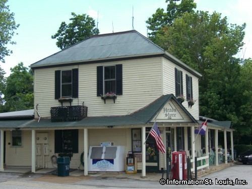
The St. Albans General Store and St. Albans Farms Stone Barn are on the National Register of Historic Places, as is Tavern Cave. The Lewis and Clark Expedition visited that cave and Meriwether Lewis nearly lost his life when slipping down the bluffs here. The expedition journals mention a whirlpool in the river, the Devil's Raceground, which is now dry land, due to a change in the course of the river: it is the portion of St. Charles County anomalously on this side of the river. For many years, the town was the country retreat of some wealthy St. Louis, Missouri families, and included Wings, a hunting club. Since the 1990s, developers changed this area to a major upscale residential community with golf courses.