
Country State | Language spoken Kannada District | |
 | ||
Map of Srinivaspur
Srinivaspur is a town located in the Kolar district of Karnataka state, India. The latitude 13.33 and longitude 78.22 are the geocoordinate of the Srinivaspur. Bangalore is the state capital for Srinivaspur town. It is located around 80.7 km away from Srinivaspur. The other nearest state capital from Srinivaspur is Chennai and its distance is 137.6 km. The other surrounding state capitals are Chennai 225.9 km., Pondicherry 233.2 km., Hyderabad 453.4 km.,
Contents
- Map of Srinivaspur
- Soul is immortal part 2 skit sfs school srinivaspur annual day 2011
- Srinivaspur masjid masjid e ansar by mansoor shariff
- Etymology
- Geography and climate
- Politics
- Demographics
- Economy
- References
Soul is immortal part 2 skit sfs school srinivaspur annual day 2011
Srinivaspur masjid masjid e ansar by mansoor shariff
Etymology
The name Srinivaspur is derived from Shree, a term for the god Vishnu, and place of abode. There is a belief that the town was once visited by Vishnu, who stayed there for some-time. In earlier times, the town was also known as Vanavasapura and, even earlier, when it was a small village, as Papanapalli.
Geography and climate
Srinivasapur is located at 13.33°N 78.22°E / 13.33; 78.22. It has an average elevation of 819 metres (2,687 ft). The geographical area of the taluk is 860 square kilometres (330 sq mi).
Srinivasapur is one of the five taluks of Kolar district. The taluk is bound by Kolar and Mulbagal taluks of Kolar district, the Chintamani taluk of Chikkaballapura district, and Chittor district in Andhra Pradesh.
The nearest towns are Chintamani, Mulbagal, Kurudumale, Kolar, Gownipally, Madanapalli, Punganur, and the Andhra Pradesh towns of Chembakur and B.Kottakota. It is 90 kilometres (56 mi) from Bangalore.
There are no perennial rivers in the taluk but Kushavati stream, which is a tributary to the Papaghni river, runs through it. There is gravelly soil in the area, which is suitable for growing groundnut, ragi and pulses. Tomato is also grown as a commercial crop.
The climate is dry and hot during summer. Average rainfall is 722 millimetres (28.4 in), which is slightly below the district average. On average, the taluk receives rain on 55 days per annum.
Politics
The taluk has 296 villages and is subdivided into five hobblies, being Srinivasapur, Ronur, Nelavanki, Rayalpad, Yeldur and Kurigepalli . Administration of the taluk is the responsibility of the taluk panchayat, which in turn reports to the zilla panchayat.
Demographics
The 2001 census of India recorded that Srinivasapur had a population of 22,926, of which males comprised 51 per cent. The average literacy rate was 64%, higher than the national average of 59.5 per cent: male literacy was 68 per cent and female literacy 58 per cent. 15 per cnet of the population was under six years of age.
Economy
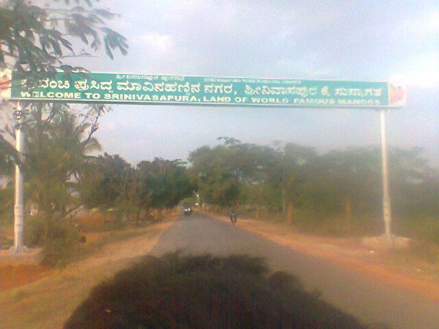
Horticulture is the major commercial, manual laboured, occupation oriented towards cultivation of mangoes and is the only place in the world where all 63 species of mango is found. The taluk is sometimes referred to as Mango City and is the biggest producer of mangoes in Karnataka
Milk and silk production are also significant products. The Professional Couriers