
Website www.spokanecounty.org Founded 30 October 1879 | Largest city Spokane Area 4,613 km² Population 479,398 (2013) Unemployment rate 6.0% (Apr 2015) | |
 | ||
Rivers Spokane River, Lake Creek, Elmer Creek Colleges and Universities Gonzaga University, Eastern Washington University, Spokane Falls Communi, Spokane Community College, Whitworth University | ||
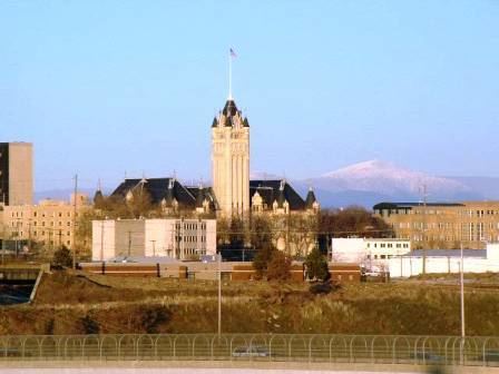
Spokane County is a county located in the U.S. state of Washington. As of the 2010 census the population was 471,221, making it the fourth-most populous county in Washington state. The largest city and county seat is Spokane, the second largest city in the state, behind Seattle.
Contents
- Map of Spokane County WA USA
- Geography
- Rivers
- Lakes and reservoirs
- Summits and peaks
- Notable parks
- National protected area
- Adjacent counties
- 2000 census
- 2010 census
- Law and government
- Towns
- Census designated places
- References
Map of Spokane County, WA, USA
Spokane County was formed on January 29, 1858. It was annexed by Stevens County on January 19, 1864, and re-created on October 30, 1879. It is named after the Spokane tribe.
Spokane County is part of the Spokane-Spokane Valley, WA Metropolitan Statistical Area, which is also part of the greater Spokane-Coeur d'Alene Combined Statistical Area that includes nearby Kootenai County, Idaho.
Geography
According to the U.S. Census Bureau, the county has a total area of 1,781 square miles (4,610 km2), of which 1,764 square miles (4,570 km2) is land and 17 square miles (44 km2) (0.9%) is water. The lowest point in the county is the Spokane River behind Long Lake Dam (boundary of Stevens County) at 1538 feet (468 m) above sea level. (There is virtually no change in elevation between the dam and the mouth of the Little Spokane River inside Riverside State Park.) The highest point in the county is the summit of Mount Spokane at 5883 feet (1793 m).
Rivers
Lakes and reservoirs
Summits and peaks
Notable parks
National protected area
Adjacent counties
2000 census
As of the census of 2000, there were 417,939 people, 163,611 households, and 106,019 families residing in the county. The population density was 237 inhabitants per square mile (92/km2). There were 175,005 housing units at an average density of 99 per square mile (38/km2). The racial makeup of the county was 88.62% White, 2.00% Black or African American, 1.40% Native American, 1.88% Asian, 0.16% Pacific Islander, 0.82% from other races, and 2.76% from two or more races. 2.77% of the population were Hispanic or Latino of any race. 22.0% were of German, 10.7% Irish, 9.9% English, 7.6% United States or American and 6.4% Norwegian ancestry.
There were 163,611 households out of which 32.40% had children under the age of 18 living with them, 49.90% were married couples living together, 11.00% had a female householder with no husband present, and 35.20% were non-families. 28.10% of all households were made up of individuals and 9.60% had someone living alone who was 65 years of age or older. The average household size was 2.46 and the average family size was 3.02.
In the county, the population was spread out with 25.70% under the age of 18, 10.60% from 18 to 24, 28.90% from 25 to 44, 22.40% from 45 to 64, and 12.40% who were 65 years of age or older. The median age was 35 years. For every 100 females there were 96.40 males. For every 100 females age 18 and over, there were 93.60 males.
The median income for a household in the county was $37,308, and the median income for a family was $46,463. Males had a median income of $35,097 versus $25,526 for females. The per capita income for the county was $19,233. About 8.30% of families and 12.30% of the population were below the poverty line, including 14.20% of those under age 18 and 8.10% of those age 65 or over.
2010 census
As of the 2010 United States Census, there were 471,221 people, 187,167 households, and 118,212 families residing in the county. The population density was 267.2 inhabitants per square mile (103.2/km2). There were 201,434 housing units at an average density of 114.2 per square mile (44.1/km2). The racial makeup of the county was 89.2% white, 2.1% Asian, 1.7% black or African American, 1.5% American Indian, 0.4% Pacific islander, 1.2% from other races, and 3.8% from two or more races. Those of Hispanic or Latino origin made up 4.5% of the population. In terms of ancestry, 27.0% were German, 15.4% were Irish, 13.5% were English, 6.9% were Norwegian, and 4.4% were American.
Of the 187,167 households, 30.9% had children under the age of 18 living with them, 47.2% were married couples living together, 11.2% had a female householder with no husband present, 36.8% were non-families, and 28.6% of all households were made up of individuals. The average household size was 2.44 and the average family size was 2.99. The median age was 36.8 years.
The median income for a household in the county was $47,250 and the median income for a family was $59,999. Males had a median income of $44,000 versus $33,878 for females. The per capita income for the county was $25,127. About 9.1% of families and 14.1% of the population were below the poverty line, including 17.0% of those under age 18 and 8.5% of those age 65 or over.
Law and government
Spokane County is governed by a partisan Board of County Commissioners, one from each of three districts. They run in a partisan primary election within their own district, then compete countywide in the general election. Other elected officials include the Sheriff, Auditor (who is also responsible for elections), Assessor, Treasurer, and Prosecutor, which are also partisan offices. Spokane County has an appointed Medical Examiner. The current commissioners for Spokane County are Josh Kerns, Shelly O'Quinn, and Al French, from the 1st, 2nd, and 3rd county districts respectively.