Constructed 6 November 1988 | Length 610 km | |
 | ||
Existed: 6 November 1988 (6 November 1988) – present | ||
Chaslands hwy the catlins southern scenic route south island new zealand
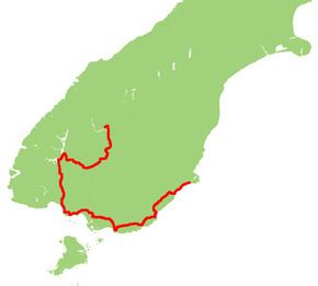
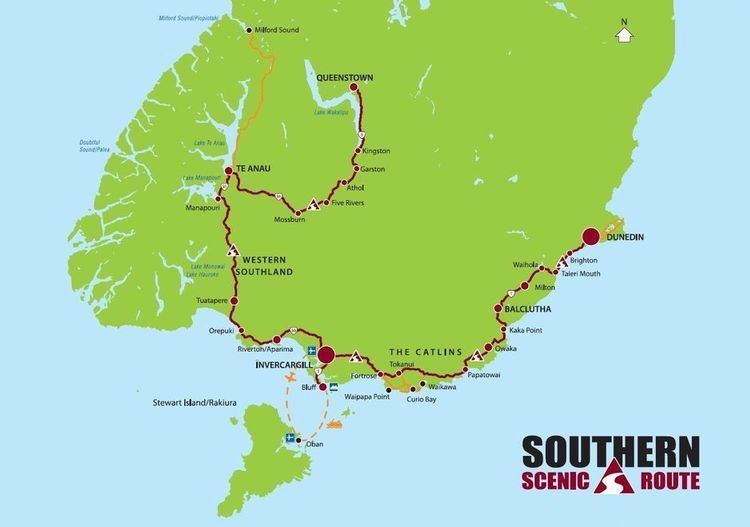
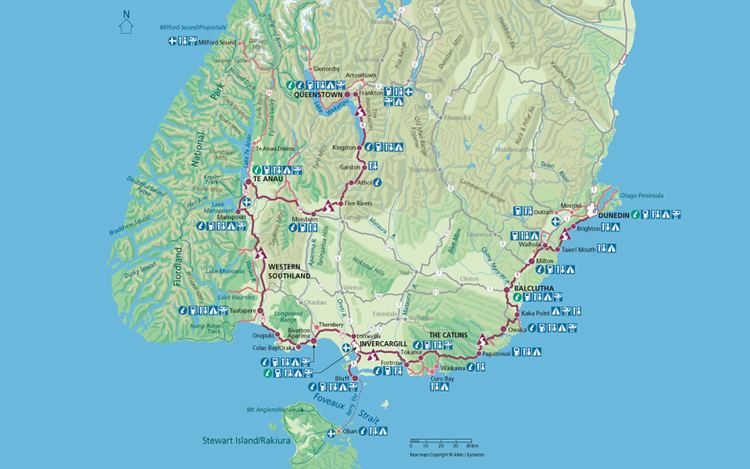
The Southern Scenic Route is a tourist highway in New Zealand linking Queenstown, Fiordland, Te Anau and the iconic Milford Road to Dunedin via, Riverton, Invercargill and The Catlins. An Australian travel magazine labelled it "one of the world's great undiscovered drives" in 2008.
Contents
- Chaslands hwy the catlins southern scenic route south island new zealand
- Owaka the catlins southern scenic route south island new zealand
- History and development
- Current route
- Proposed extensions
- References
Owaka the catlins southern scenic route south island new zealand
History and development
The Southern Scenic Route concept and name were conceived at an informal gathering in Tuatapere in November 1985 and confirmed at a public meeting in January 1986. The promotors then negotiated with road and tourism authorities and local government.
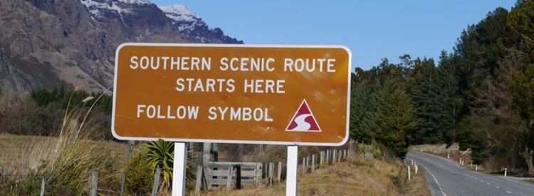
The project was a first for New Zealand and approval was a slow process. At one stage, traffic signs were installed in a clandestine operation. The Route opened officially on 6 November 1988, initially running between Te Anau in the west and Balclutha in the east. It was extended from Balclutha to Dunedin in 1998 and from Te Anau to Queenstown in 2010.
Current route
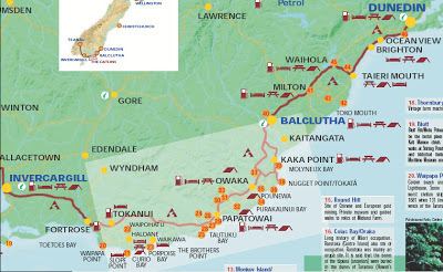
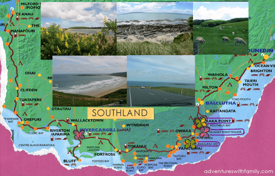
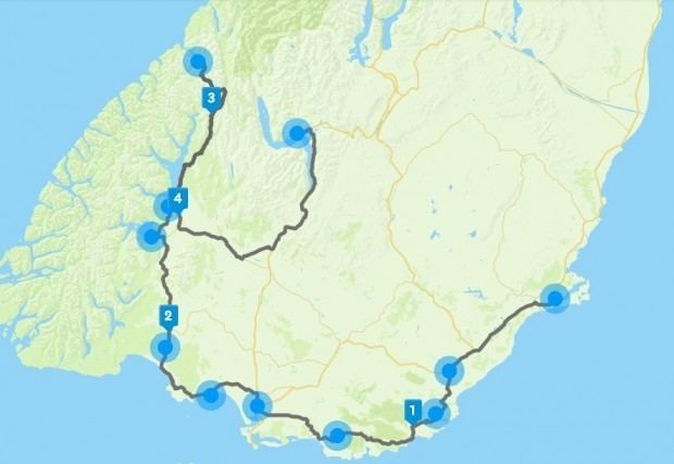
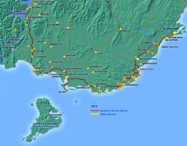
The Route runs in a U shape from Queenstown to Dunedin. Skirting the eastern boundary of Fiordland National Park, it passes Manapouri and Tuatapere. At Te Waewae Bay the coast is reached and the route swings eastward towards Orepuki, Colac Bay and Riverton. At Lorneville the New Zealand state highway network is joined, and the Southern Scenic Route runs on State Highway 6 for just eight kilometres south into Invercargill.
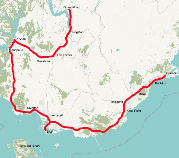
From Invercargill it heads east through Fortrose into the Catlins then through Owaka to Balclutha. This part was formerly State Highway 92. The next section of rugged coastline with poor roading through Kaitangata is avoided, as the Southern Scenic Route follows State Highway 1 (SH 1) to Milton and Lake Waihola.
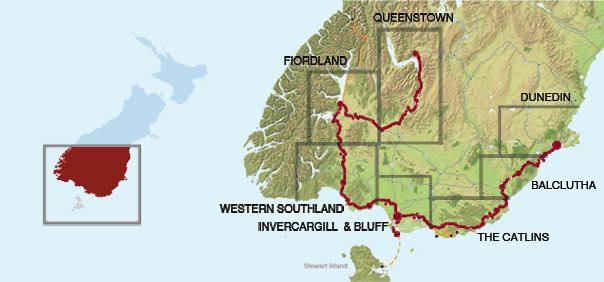
The Route leaves the highway at Waihola and climbs through Otago Coast Forest rejoining the coastline at Taieri Mouth. From here it follows secondary roads through Brighton and Green Island, ending where it meets SH 1 again at Caversham.
Proposed extensions
In early 2007 a proposal arose to extend the route northward beyond Dunedin through Waitati. In November 2007, the Dunedin City Council confirmed that it planned to talk with the Waitaki District Council about extending the route to Oamaru, an idea that was not adopted.