
Region Southland Local time Monday 8:11 AM | Elevation 200 m (700 ft) Number of airports 1 | |
 | ||
Weather 14°C, Wind N at 23 km/h, 70% Humidity | ||
Manapouri is a small town in Southland / Fiordland, in the southwest corner of the South Island, in New Zealand. The township is the westernmost municipality in New Zealand. Located at the edge of the Fiordland National Park, on the eastern shore of Lake Manapouri, close to its outflow into the Waiau River, tourist boat services are based in the town.
Contents
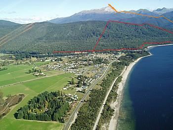
Map of Manapouri 9679, New Zealand
Manapouri township is a 20 minutes drive from Te Anau via State Highway 95. The town is the gateway to both Doubtful Sound and Dusky Sound and the starting point for many local walking tracks. It is a popular tourist destination, particularly during the summer months. The Manapouri Hydroelectric Power Station is located on West Arm of Lake Manapouri, with most of the electricity generated serving the Tiwai Point Aluminium Smelter. Workers at the power plant are ferried by boat from Manapouri, as there is no road access to the power station.
Facilities
Commercial services include a petrol station/garage, art gallery, cafes, shops, two restaurant and bars as well as overnight hotel, motel and motor camp accommodations. The small Te Anau Airport is situated 5 kilometres (3.1 mi) north of the township and serves both Te Anau and Manapouri.
There are several tourist boat excursions based in Manapouri to service the Fiordland Sounds to fishing charters and boat hire. Excursions originating at Pearl Harbour at the southern end of Manapouri township take tourists across Lake Manapouri to view the underground hydroelectric facility, or continue on by bus over Wilmot Pass to boat tours of Doubtful Sound, adding up to a full day trip.
Walkways & Cycleways
Day walks are the Circle Track, the Hope Arm Track, the Shallow Bay portion of the Kepler Track and the Frazers Beach Reserve walkways.
Supply Bay Road and the Rainbow Reach area are reasonably cycle-friendly. The Manapouri-Te Anau Cycle trail is currently still under negotiation between the Department of Conservation and the Fiordland Trails Trust.
Kayaking
The eastern end of Lake Manapouri is possibly the best waterway in New Zealand for kayak exploration with 20 islands and many coves, beaches, lagoons, waterfalls, huts, portages and channels with in a days return paddled from Manapouri township.
Monuments
At the intersection of State Highway 95 and Hillside Road is a monument to the Save Manapouri campaign which marks the first mass environmental movement in New Zealand history.
A natural monument, in the form of Monument Hill, lies across the lake from the township. This sharply pointed landmark beneath the Hunter Mountains to the west on Manapouri township is a prized destination for adventurous trampers.
Climate
Manapouri has an oceanic climate (Cfb) under the Köppen climate classification with mild summers and cool to cold winters. In a typical winter season, snowfalls and snow on the ground are likely on a handful of occasions.