
- average 454 cu ft/s (13 m/s) Length 105 km Basin area 880.6 km² Source Lake Angela | - min 1 cu ft/s (0 m/s) Discharge 13 m³/s Basin area 881 km² | |
 | ||
- max 53,600 cu ft/s (1,518 m/s) Mouths | ||
Nevada city ca south yuba river shot with gopro session
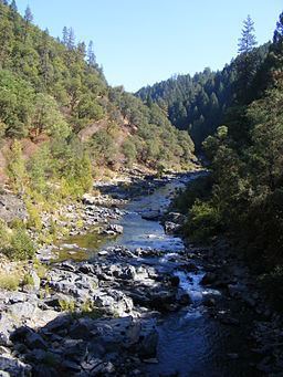
The 65.0-mile-long (104.6 km) South Yuba River is a left-entering tributary of the Yuba River originating in the northern Sierra Nevada at Lake Angela in Nevada County about three quarters of a mile north of Donner Pass, about three miles east of the town of Soda Springs. After passing through Lake Van Norden with Upper Castle Creek (longer than the Lake Angela stem) entering from the right, it gathers numerous snow-fed tributaries running west through a marshy, lake-filled valley, criss-crossing Interstate 80. The river briefly enters Placer County, then flows into Lake Spaulding, then plunges westward into a steep-sided valley. Canyon Creek enters from the right, then Poorman Creek also from the right near the town of Washington. The river continues west into the foothills, crossing under State Route 49. Its mouth is on the east shore of upper Englebright Lake, formed by a dam across the Yuba River.
Contents
- Nevada city ca south yuba river shot with gopro session
- Map of South Yuba River California USA
- South yuba river swimming hole
- Recreation
- References
Map of South Yuba River, California, USA
South yuba river swimming hole
Recreation
The river begins within the Tahoe National Forest. Parks along or near the South Yuba Rive include: