
- average 40.5 cu ft/s (1 m/s) | - elevation 3,503 ft (1,068 m) - elevation 1,453 ft (443 m) Length 470 km | |
 | ||
- max 7,260 cu ft/s (206 m/s) | ||
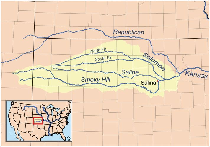
The South Fork Solomon River is a 292-mile-long (470 km) river in the central Great Plains of North America. The entire length of the river lies in the U.S. state of Kansas. It is a tributary of the Solomon River.
Contents
Map of South Fork Solomon River, Carr Creek, KS, USA
GeographyEdit
The South Fork Solomon River rises in Sherman County, Kansas, and flows eastward through Thomas and Sheridan counties into Graham County.
The South Fork Solomon River travels across Graham County roughly following the course of Highway 24. The South Fork Solomon River enters Graham County about ½ mile (0.8 km) south of Studley and exits Graham County about 5 miles (8.0 km) southwest of Nicodemus. The river runs though Bogue, Hill City, Penokee, Morland and Studley, and is impounded eight miles west of Stockton, Kansas in Rooks County to form the large Webster Reservoir.
The river then joins the North Fork Solomon River at Waconda Lake in northwestern Mitchell County, forming the Solomon River.