
- average 121 cu ft/s (3 m/s) | - elevation 3,362 ft (1,025 m) - elevation 1,453 ft (443 m) Length 462 km | |
 | ||
- max 32,300 cu ft/s (915 m/s) | ||
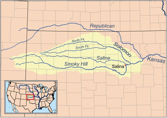
The North Fork Solomon River is a river in the central Great Plains of North America. Its entire 287-mile (462 km) length lies within the U.S. state of Kansas. It is a tributary of the Solomon River.
Contents
Map of North Fork Solomon River, Carr Creek, KS, USA
Geography
The North Fork Solomon River originates in the High Plains of northwest Kansas. Its source lies in west-central Thomas County roughly 8 miles (13 km) southeast of Brewster, Kansas. From there, it flows generally east-northeast into the Smoky Hills region of north-central Kansas. Southeast of Phillipsburg, Kansas, the river joins its tributary Bow Creek to feed Kirwin Reservoir. From the reservoir's dam, the river flows east, then turns southeast near Gaylord, Kansas. Immediately south of Cawker City in northwestern Mitchell County, the North Fork joins the South Fork Solomon River to feed Waconda Lake.
History
In 1955, the U.S. Bureau of Reclamation completed a dam on the river immediately south of Kirwin, Kansas for flood control, creating Kirwin Reservoir.