
- elevation 5,396 ft (1,645 m) - average 179 cu ft/s (5 m/s) Discharge 5.069 m³/s | - elevation 2,326 ft (709 m) Length 97 km Basin area 1,570 km² | |
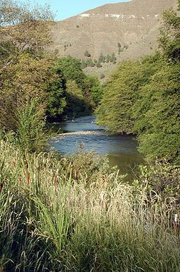 | ||
The South Fork John Day River is a 60-mile (97 km) tributary of the John Day River in the U.S. state of Oregon. It begins in the Malheur National Forest in Harney County about 25 miles (40 km) north-northwest of Burns and flows generally north to Dayville, where it meets the main stem of the John Day River. Along the way, the stream passes through the abandoned town of Izee. Black Canyon Wilderness in the Ochoco National Forest lies within the river's drainage basin.
Map of South Fork John Day River, Oregon, USA
A total of 47 miles (76 km) of the river, from the Malheur National Forest boundary to Smoky Creek, are classified "recreational" in the National Wild and Scenic River (NWSR) system and offer opportunities for hiking, swimming, camping, hunting, and fishing.
References
South Fork John Day River Wikipedia(Text) CC BY-SA