
Visitors 575,000 (in 2006) Website Ochoco National Forest Established July 1, 1911 | Governing body U.S. Forest Service Area 3,444 km² Nearest city Mitchell | |
 | ||
Management United States Forest Service | ||
Mac plymale the ochoco national forest
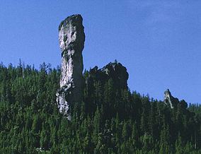
The Ochoco National Forest is located in Central Oregon in the United States, north and east of the city of Prineville, location of the national forest headquarters. It encompasses 850,000 acres (3,440 km2) of rimrock, canyons, geologic oddities, dense pine forests, and high desert terrain, as well as the headwaters of the North Fork Crooked River. A 1993 Forest Service study estimated that the extent of old growth in the forest was 95,000 acres (38,000 ha).
Contents
- Mac plymale the ochoco national forest
- Map of Ochoco National Forest Oregon USA
- Wilderness
- Recreation
- References
Map of Ochoco National Forest, Oregon, USA
In descending order of forestland area, it occupies lands within Crook, Harney, Wheeler, and Grant counties. The national forest also administers the Crooked River National Grassland, which is in Jefferson County.
The Ochoco National Forest is composed of three ranger districts:
Wilderness
The forest contains three wilderness areas comprising 36,200 acres (146 km2):
Recreation
Popular recreational activities in the Ochoco National Forest include hiking, fishing, camping, hunting, horseback riding, stargazing, birding and rock hounding.